Mountain refuge Waldhütte Hornen
We have it listed in the app!
We have it listed in the app!
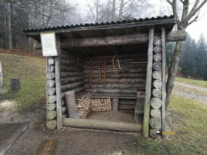

Located in the heart of waldweg, bennwil, bezirk waldenburg, basilea-campiña, 4431, suiza, the Waldhütte Hornen refuge offers shelter at 771 meters above sea level. Ideal for trekking and nature lovers, this mountain shelter (Lat: 47.388, Lon: 7.78) is the perfect starting point or resting place for local routes.
12.8°C
Feels like: 11.4°C7.2 km/h
Gusts: 18.4 km/h3530 m
Snow lineUV 0.55
Clouds: 100% 8.4 mm
 20 km/h
 UV máx: 5.2
 05:34
05:34
 21:20
2.9 mm
13 km/h
UV máx: 4.55
05:34
21:20
0.1 mm
12.9 km/h
UV máx: 7.1
05:33
21:21
0 mm
11.2 km/h
UV máx: 5.65
05:33
21:22
0 mm
14.5 km/h
UV máx: 6.6
05:32
21:23
2.25 mm
14.4 km/h
UV máx: 5.5
05:32
21:23
0 mm
6.4 km/h
UV máx: 6.95
05:32
21:24
21:20
2.9 mm
13 km/h
UV máx: 4.55
05:34
21:20
0.1 mm
12.9 km/h
UV máx: 7.1
05:33
21:21
0 mm
11.2 km/h
UV máx: 5.65
05:33
21:22
0 mm
14.5 km/h
UV máx: 6.6
05:32
21:23
2.25 mm
14.4 km/h
UV máx: 5.5
05:32
21:23
0 mm
6.4 km/h
UV máx: 6.95
05:32
21:24
Between the forest reliefs and the lomas of the Waldenburg district, Waldhütte Hornen it fits better as a starting point than as an isolated destination. Its position, in the surroundings of Bennwil and within Basilea-Campiña, places it close to several hiking itineraries that link steps and soft crest from this part of the Swiss Jura, where the orientation on the map and the management of the effort weigh more than the technical difficulty.
At 771 meters of altitude, it can be useful to break long days or to introduce an intermediate pause on routes that pass through Ober Hauenstein , the axis E4 in its Swiss section or links to Passwang and Langenbruck. It is not a context of high Pyrenian mountain, but a half-mountain transit, with more contained levels but with routes that can be extended if hills, forests and side changes are chained. In this sense, the shelter is of particular interest to those who plan continuous stages and need a clear road point of reference.
The nearby landscape is marked by elevations such as Belchenflue, Bergfluh or Dangerenflue, summits and highlights that help to read the area and understand the network of roads through these saws. Rather than serving as a basis for demanding ascension, the shelter functions as logistical support on a mountain of orientation, crosses and links, where it is appropriate to review the route planned before leaving.
In the area of autonomy, the most practical reference is the presence of a source at about 490 metres, a reasonable distance but it is not appropriate to be determined without checking flow and conditions on the ground. If a long stage or step outside of the clearer routes is proposed, it is prudent to carry sufficient water and not to depend on finding unconfirmed additional supply or equipment.


📏 2.4 Km
⛰️ 640 m

📏 2.7 Km
⛰️ 840 m

📏 4.5 Km
⛰️ 964 m

📏 4.5 Km
⛰️ 827 m

📏 4.6 Km
⛰️ 910 m

📏 5.3 Km
⛰️ 755 m

📏 5.3 Km
⛰️ 741 m

📏 5.9 Km
⛰️ 805 m
Download the app and start looking for the shelter of your next adventure


Find a place to sleep before night falls.


