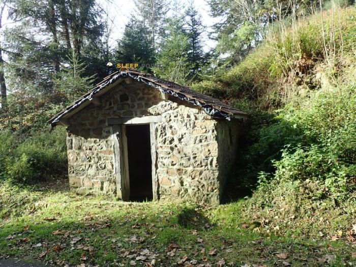
Mountain refuge Suchaillou
We have it listed in the app!
We have it listed in the app!


Conquering the trails of le suchaillou, route d'araules, raffy, queyrières, le puy-en-velay, alto loira, auvergne-rhône-alpes, francia metropolitana, 43260, francia is easier with the Suchaillou refuge. Located at 1250 m (coordinates 45.068, 4.118), it is the ideal shelter against harsh mountain weather.
12.1°C
Feels like: 10.7°C8.2 km/h
Gusts: 31.7 km/h3570 m
Snow lineUV 1.15
Clouds: 100% 16.4 mm
 16.3 km/h
 UV máx: 1.05
 05:58
05:58
 21:25
0 mm
14.8 km/h
UV máx: 7.2
05:57
21:26
0.1 mm
21.7 km/h
UV máx: 7.65
05:57
21:26
0 mm
6.4 km/h
UV máx: 7.4
05:57
21:27
0 mm
18.4 km/h
UV máx: 7.5
05:56
21:28
0 mm
18 km/h
UV máx: 6.5
05:56
21:28
0 mm
17.9 km/h
UV máx: 7.25
05:56
21:29
21:25
0 mm
14.8 km/h
UV máx: 7.2
05:57
21:26
0.1 mm
21.7 km/h
UV máx: 7.65
05:57
21:26
0 mm
6.4 km/h
UV máx: 7.4
05:57
21:27
0 mm
18.4 km/h
UV máx: 7.5
05:56
21:28
0 mm
18 km/h
UV máx: 6.5
05:56
21:28
0 mm
17.9 km/h
UV máx: 7.25
05:56
21:29
A half-mountain volcanic environment. About 1,250 metres, around Raffy and Queyrières , this coat is located within the Meygal , a wavy area of relief and rounded peaks of the Alto Loira that works more as a territory of transition and journey than as a large alpine knot. This position gives it a particular character: it can serve as a support for moving through the near elevations, but without the context of a marked journey or a clearly associated classic itinerary. In the nearby landscape there are heights like Le Chabrier , Mont Chanis or La Tortue, modest heights that help to read the ground and understand that here the orientation depends more on the chaining of loins, forests and tracks than on a large reference valley.
For its location, Suchaillou it fits better as a simple basis for a day in the massif than as a forced transit shelter. The altitude is not extreme, but is sufficient to notice rapid changes in time, fog or wind on an open and exposed mountain in some heights. The approach should be raised with margin, especially if it is intended to link several secondary summits or to travel the cordon without obvious references. There is a source practically next to the shelter, a useful data for the logistics, although in mountain it is always reasonable to confirm its state before depending on it. Since there are no specific associated routes or reliable details about interior equipment, it is wise to have autonomy, to carry well prepared mapping or drawing and not to take for granted more services than those strictly known.


📏 1.8 Km
⛰️ 1300 m

📏 2.3 Km
⛰️ 1360 m

📏 10.5 Km
⛰️ 768 m

📏 14.6 Km
⛰️ 1189 m

📏 18.5 Km
⛰️ 808 m

📏 21.8 Km
⛰️ 665 m

📏 25.8 Km
⛰️ 1120 m
📏 26.9 Km
⛰️ 845 m
Download the app and start looking for the shelter of your next adventure


Find a place to sleep before night falls.


