Mountain refuge Refugio de la dehesilla
We have it listed in the app!
We have it listed in the app!


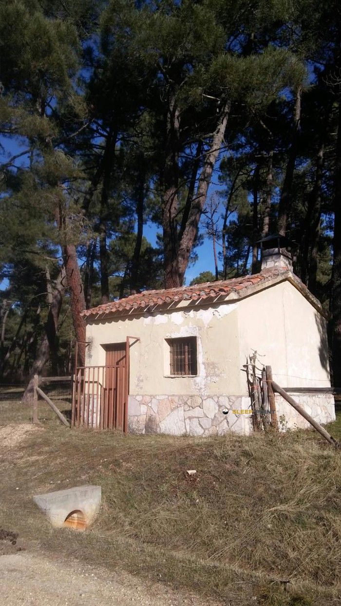
The mountains of refugio de la dehesilla, pista forestal a costalago, hontoria del pinar, burgos, castilla y león, 09660, españa hide essential places like the Refugio de la dehesilla refuge. Situated at an elevation of 1045 meters, it offers protection and rest. Its exact coordinates are 41.797, -3.185.
13.6°C
Feels like: 11.3°C15.2 km/h
Gusts: 34.9 km/h3990 m
Snow lineUV 1.6
Clouds: 95% 0 mm
0 mm
 19.7 km/h
 UV máx: 6.7
 06:39
06:39
 21:43
0 mm
15.9 km/h
UV máx: 7.7
06:38
21:43
0 mm
13.3 km/h
UV máx: 8
06:38
21:44
0 mm
15.5 km/h
UV máx: 7.8
06:38
21:45
0 mm
19.7 km/h
UV máx: 8.2
06:37
21:45
0 mm
14.8 km/h
UV máx: 7.85
06:37
21:46
0 mm
14.5 km/h
UV máx: 7.85
06:37
21:46
21:43
0 mm
15.9 km/h
UV máx: 7.7
06:38
21:43
0 mm
13.3 km/h
UV máx: 8
06:38
21:44
0 mm
15.5 km/h
UV máx: 7.8
06:38
21:45
0 mm
19.7 km/h
UV máx: 8.2
06:37
21:45
0 mm
14.8 km/h
UV máx: 7.85
06:37
21:46
0 mm
14.5 km/h
UV máx: 7.85
06:37
21:46
The Refuge de la dehesilla is located at a geographical crossroads that allows to alternate its use as a basis for local ascension or as a key point of passage on half-distance crossings. At 1045 meters of altitude, this site acts as a link between the low valleys and the elevations that mark the provincial divide, offering a privileged perspective on the relief of the area. For the mountain man who seeks to coronate reliefs like the Head of the Aro or Alto del Mojón the location is strategic, as it allows to manage the approaches to these cords without the need to return immediately to the population cores. Its position facilitates the understanding of the terrain, dominated by forest formations and limestone florings that characterize this sector of the Burgalese Iberian system, serving as a constant visual reference before taking up levels towards the Pico de las Navas .
The usefulness of this shelter is evident in analyzing its relationship with the long-distance routes that cross the region. It is linked to the logistics of routes such as the Senda del Río (PR-SO 65) and Senda de Hontoria (PR-BU 5), in addition to being in the area of influence of the Camino Jacobeo Castellano - Aragonés . This network of trails makes the shelter a valuable resource for fragmenting extensive stages, allowing the walkers to travel between San Leonardo de Yagüe and Mamolar to adjust their days according to the pace of march or weather conditions. It is not just a night place, but a safety reference in an environment where mountain transit requires careful planning of the times, orientation and knowledge of the cords that separate the different river basins.
As it is a free shelter , the user profile must be marked by the autonomy and technical foresight. A key factor in planning is the management of water , because the nearest sources are located at a considerable distance, in most cases exceeding three kilometres of route from the structure. This requires sufficient prior portage from guaranteed supply points in the valley. In the absence of detailed information on the state of the interior equipment, it is essential that the mountaineer has its own equipment of overnight and thermal insulation. Self-sufficiency is the norm in this environment, where isolation relative to the services of Hontoria del Pinar requires rigorous preparation to face any change in the mountain atmosphere and exposure to the winds in the nearby hills.


📏 0.5 Km
⛰️ 1041 m

📏 1 Km
⛰️ 1094 m

📏 1.8 Km
⛰️ 1081 m

📏 2 Km
⛰️ 1117 m

📏 2.1 Km
⛰️ 1095 m

📏 10.3 Km
⛰️ 1139 m

📏 10.8 Km
⛰️ 1159 m

📏 11.9 Km
⛰️ 1176 m
Download the app and start looking for the shelter of your next adventure


Find a place to sleep before night falls.


