Mountain refuge Refuge des Oulettes de Gaube

We have it listed in the app!


            Mountain refuge Refuge des Oulettes de Gaube in refuge des oulettes de gaube, sentier du col peyrot au vallon de pouey trenous, cauterets, argelès-gazost, altos pirineos, occitania, francia metropolitana, 65110, francia
Five orange stars in a horizontal row representing a five-star rating.

Refuge des Oulettes de Gaube

Lat: 42.793xxx – Lon: -0.141xxx
📍 refuge des oulettes de gaube, sentier du col peyrot au vallon de pouey trenous, cauterets, argelès-gazost, altos pirineos, occitania, francia metropolitana, 65110, francia
Refuge des Oulettes de Gaube

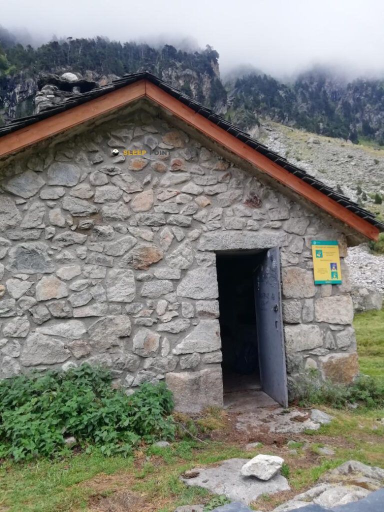
At 2150 meters above sea level, nestled in refuge des oulettes de gaube, sentier du col peyrot au vallon de pouey trenous, cauterets, argelès-gazost, altos pirineos, occitania, francia metropolitana, 65110, francia, stands the Refuge des Oulettes de Gaube refuge. It is the perfect stop to spend the night or catch your breath. GPS coordinates: 42.793, -0.141.

See more
See more
Usuario

Lucas Martinez

Premium user

Live weather: Refuge des Oulettes de Gaube

The current weather in Refuge des Oulettes de Gaube indicates a temperature of 6.5°C, although the 11.1 km/h wind makes it feel like 1.1°C. Watch out for gusts of 43.6 km/h. The snow altitude (freezing level 0°) is around 4340 m and today we will reach a high of 7.1°C.
Temperature

6.5°C

Feels like: 1.1°C
Wind

11.1 km/h

Gusts: 43.6 km/h
Freezing level 0°

4340 m

Snow line
Sky & UV

UV 0

Clouds: 94%

Next 48 hours evolution

7-day forecast

04/06
7.1° 1.6°
11 mm 13.2 km/h UV máx: 5.15
06:23 21:34
05/06
-4.1°
0.1 mm 13.7 km/h UV máx: 8.15
06:23 21:35
06/06
11.2° 1.7°
0 mm 7.6 km/h UV máx: 7.9
06:22 21:35
07/06
13.2° 3.6°
0 mm 11 km/h UV máx: 8.05
06:22 21:36
08/06
18.5° 7.5°
0 mm 11.4 km/h UV máx: 8.3
06:22 21:36
09/06
15.5° 6.9°
0.3 mm 9.4 km/h UV máx: 7.95
06:22 21:37
10/06
17.1° 6.7°
0 mm 7.7 km/h UV máx: 7.9
06:21 21:38

Open ground, serious altitude and little protection. The Refuge des Oulettes de Gaube , at the end of Cauterets and at 2,150 meters, it fits into an atmosphere of glacier valley and mountain very exposed to rapid changes of time. Its position in the Oulettes de Gaube sector places it at a level where the wind, fog or a sudden drop in temperature can make the day very difficult. The approach is developed by mountain path and it is appropriate to have sufficient physical margin, especially if you arrive with a backpack or if the shelter is used to link long days. At this point there is an important practical reference: there is a very close source, a few meters away, although in mountain it is always reasonable to foresee autonomy and confirm the real conditions before leaving.

More than just as a stop, this shelter functions as logistical support within long-distance routes. The presence of stages of HRP in the environment it strengthens its role as a point of passage, reorganisation or withdrawal if the weather is complicated in height. It can also be used to fail tours in the border area between the French Pyrenees and the axis that connects with itineraries to Bachimaña and Brazatos, although the distances depend on the chosen route. The geographical framework helps to be oriented: it is located in the area of the Viñamala massif, under a very mineral and strong relief valley, where navigation is easier with good visibility than with low cloud. Because of its location and context, it is especially useful for mountaineers used to pyrenees, long stages and quick decisions on continuity or descent.

Hiking routes from the refuge

GR 11

Variante Bachimaña - Ibon de Brazatos

↔ Variable distance
HRP

HRP Étape 13

↔ Variable distance
HRP

Étape 14

↔ Variable distance
HRP

HRP Étape 15

↔ Variable distance
Local

Ruta circular de los Infiernos-Ibones Azules-Bachimañaa

↔ Variable distance
Local

Chemin des Cascades dans le Val de Jéret

↔ Variable distance
Local

A travers la vallée du Marcadau vers le refuge Wallon

↔ Variable distance
Local

Lac d'Arratille

↔ Variable distance

Nearby water fountains

Fuente

7 m
Lat: 0 Lon: 0

Fuente

2.06 Km
Lat: 0 Lon: 0

Fuente

2.56 Km
Lat: 0 Lon: 0

Fuente

4.61 Km
Lat: 0 Lon: 0

Fuente

5.29 Km
Lat: 0 Lon: 0

Fuente

6.52 Km
Lat: 0 Lon: 0

Fuente

7.19 Km
Lat: 0 Lon: 0

Fuente

7.58 Km
Lat: 0 Lon: 0
FAQ

Frequently asked questions

Pregunta frecuente
Are there other mountain refuges near Refuge des Oulettes de Gaube?
Yes, nearby you can find other options to spend the night or take shelter. El refugio más próximo es el Refuge de Bayssellance, que se encuentra a aproximadamente 2.1 km de distancia.
Pregunta frecuente
At what exact altitude is the Refuge des Oulettes de Gaube refuge located?
The Refuge des Oulettes de Gaube refuge is located at an altitude of 2150 meters above sea level, in the natural surroundings of refuge des oulettes de gaube, sentier du col peyrot au vallon de pouey trenous, cauterets, argelès-gazost, altos pirineos, occitania, francia metropolitana, 65110, francia.
Pregunta frecuente
What are the GPS coordinates of the Refuge des Oulettes de Gaube refuge?
To locate the Refuge des Oulettes de Gaube refuge on your GPS or map, use the following coordinates: Latitude 42.793 and Longitude -0.141.
More areas

Other areas

Collaborative

Together we improve

image

Send your photos

You can upload photos of shelters and update their status so other users know if they can go there.

Get started
Get started
image

Rate the shelter

Leave your comments to rate the shelter’s condition. In the mountains, we look after each other.

Get started
Get started
image

Add new ones

Did we miss any? Publish the shelters you know so everyone can use them.

Get started
Get started
Download for free from the Apple App Store and Play Store.

Download the app and start looking for the shelter of your next adventure

Aplicación móvil para encontrar refugios de montaña donde dormir
Aplicación móvil para encontrar refugios de montaña donde dormir.
Mapa interactivo de refugios de montaña en los Pirineos dentro de la app
Mapa de refugios de montaña para senderismo y trekking en la app.
Pantalla con información de refugio de montaña con altitud capacidad y servicios
Pantalla con información de refugio de montaña con altitud capacidad y servicios.
Detalles de refugio de montaña con servicios y meteorología en aplicación móvil
Detalles de refugio de montaña con servicios y meteorología en aplicación móvil.
Aplicación para explorar refugios de montaña mediante mapa interactivo
Aplicación para explorar refugios de montaña mediante mapa interactivo.
Ficha completa de refugio de montaña con opiniones y servicios
Ficha completa de refugio de montaña con opiniones y servicios.
Información detallada de refugio en app para montañeros
Información detallada de refugio en app para montañeros.
Listado de refugios de montaña para senderismo y trekking
Listado de refugios de montaña para senderismo y trekking.
Explorar refugios de montaña desde una aplicación móvil
Explorar refugios de montaña desde una aplicación móvil.