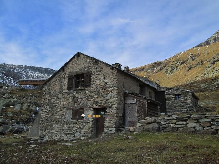
Mountain refuge Refuge de Peclet-Polset
We have it listed in the app!
We have it listed in the app!
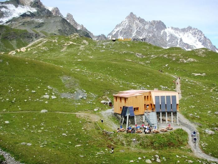

With a privileged location in refuge de péclet-polset, sentier du col de chavière, pralognan-la-vanoise, albertville, saboya, auvergne-rhône-alpes, francia metropolitana, 73710, francia, the Refuge de Peclet-Polset refuge awaits you at 2474 meters of altitude. Note its position (45.289, 6.659) before starting your route through the mountain range or massif.
5.1°C
Feels like: 1.8°C3.4 km/h
Gusts: 4.3 km/h4080 m
Snow lineUV 0
Clouds: 73% 28.6 mm
 12.6 km/h
 UV máx: 7.35
 05:47
05:47
 21:16
1.6 mm
15.1 km/h
UV máx: 7.25
05:46
21:16
0.3 mm
16.7 km/h
UV máx: 8.05
05:46
21:17
0 mm
12.1 km/h
UV máx: 8.1
05:46
21:18
2.25 mm
12.6 km/h
UV máx: 7.6
05:45
21:19
1.2 mm
14.8 km/h
UV máx: 5.1
05:45
21:19
0.3 mm
8.3 km/h
UV máx: 7.9
05:45
21:20
21:16
1.6 mm
15.1 km/h
UV máx: 7.25
05:46
21:16
0.3 mm
16.7 km/h
UV máx: 8.05
05:46
21:17
0 mm
12.1 km/h
UV máx: 8.1
05:46
21:18
2.25 mm
12.6 km/h
UV máx: 7.6
05:45
21:19
1.2 mm
14.8 km/h
UV máx: 5.1
05:45
21:19
0.3 mm
8.3 km/h
UV máx: 7.9
05:45
21:20
In the field of Pralognan-la-Vanoise and within the alpine frame of the Vanoise , this shelter is located at a point that helps to read the map of the area: close to the axis of the GR 55 and the sentier du col de Chavière, in a high mountain strip where the valleys open to different hills and basins. At 2474 meters, the ground already responds to a clearly alpine logic, with open relief, quick changes of time and references that should be carried well identified before leaving.
Peclet-Polset Refuge It is mainly in support of cross-roads and for days that link slopes between Pralognan, the surroundings of Aussis and the itineraries that approach the Vallon de l'Orgère or the Lac du Généry. More than just an isolated destination, it works as an intermediate reference in a network of mountain steps where orientation matters, especially if it is intended to continue towards hills like that of Aussis or to move under summits that dominate the sector, including the Aiguille de Péclet and Pointe de l'Observatoire . This position gives you the value to divide long routes and to plan stages with a criterion of level, exposure and meteorology.
In planning, autonomy should be taken into account. The registered sources do not appear next to the shelter, but several kilometres away, so it is not wise to have immediate water without first verifying the actual conditions of the itinerary. It is also interesting to check well mapping and weather: at this point, a seemingly clear route can become more demanding if fog, wind or residual snow enter. For those who prepare a mountain shelter in the Vanoise with the idea of linking routes, the main value here is in its geographical position and in how it orders the passage between different high mountain sectors.


📏 3.7 Km
⛰️ 2338 m

📏 5 Km
⛰️ 1911 m

📏 5.2 Km
⛰️ 2511 m

📏 5.7 Km
⛰️ 2126 m

📏 5.7 Km
⛰️ 2126 m

📏 5.8 Km
⛰️ 2358 m

📏 6.7 Km
⛰️ 2320 m

📏 6.8 Km
⛰️ 1985 m
Download the app and start looking for the shelter of your next adventure


Find a place to sleep before night falls.


