Mountain refuge Pichoux
We have it listed in the app!
We have it listed in the app!


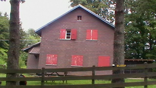
Prepare your backpack and head to 40, chemin du pichoux, courtemautruy, courgenay, district de porrentruy, jura, 2950, suiza. There you will find the Pichoux refuge at 565 meters of elevation. An essential stop along the way (Lat: 47.391, Lon: 7.137) for any mountain enthusiast.
13.1°C
Feels like: 11.3°C11.6 km/h
Gusts: 23.8 km/h2440 m
Snow lineUV 0.05
Clouds: 100% 8.7 mm
 21.8 km/h
 UV máx: 3.4
 05:36
05:36
 21:22
3.6 mm
15.3 km/h
UV máx: 6.1
05:36
21:23
0 mm
13.5 km/h
UV máx: 7.1
05:36
21:24
0 mm
14.2 km/h
UV máx: 6.5
05:35
21:25
0.9 mm
14.1 km/h
UV máx: 7
05:35
21:25
1.8 mm
17 km/h
UV máx: 5.55
05:34
21:26
0 mm
13.2 km/h
UV máx: 6.65
05:34
21:27
21:22
3.6 mm
15.3 km/h
UV máx: 6.1
05:36
21:23
0 mm
13.5 km/h
UV máx: 7.1
05:36
21:24
0 mm
14.2 km/h
UV máx: 6.5
05:35
21:25
0.9 mm
14.1 km/h
UV máx: 7
05:35
21:25
1.8 mm
17 km/h
UV máx: 5.55
05:34
21:26
0 mm
13.2 km/h
UV máx: 6.65
05:34
21:27
Pichoux appears in the Courtemautruy sector, within the Swiss canton of Swear , at a moderate level of 565 metres. It does not respond to the high-altitude alpine shelter scheme, but to the basic support scheme in a half-mountain area where land reading, direction changes and continuity of the itinerary weigh more than height. The nearby relief is organized between forest lomas, local steps and soft mountains, with Mont Terri relatively close, which helps to understand its role as a point of guard or pause within wider routes.
In this environment there are several local trails that link cores and sections such as Damphreux, Coeuvre, Sur le Mont, Montignez or Bourrignon. This makes it possible for the shelter to fit both on a linear day and on a small journey in short stages, but it is appropriate to assess whether to deviate to it compensates according to the chosen route. In the Jura, the routes can alternate paths, forest paths and frequent orientation changes, so it is not always enough to follow an obvious direction on the ground.
The logistics here calls for some autonomy. The registered sources are not attached to the shelter: the nearest ones are just over 2.5 km away, a distance sufficient to not have immediate water on arrival. For careful planning, it is appropriate to go out with determined water or to provide the recharge point within the itinerary, not at the end. It is also reasonable to note that, although the altitude is not high, the weather of the Jura can change the sense of progress in open areas or in forest edges.
As a mountain access and orientation point, their interest is less in the gap and more in the position within a network of roads in the district of Porrentuy. It can be used to break a day, to cover a basic need for shelter or to support tours between nearby communes, always with a simple but attentive preparation to the layout, water and the exposure of the day.


📏 1.6 Km
⛰️ 666 m

📏 4.3 Km
⛰️ 526 m

📏 5 Km
⛰️ 525 m

📏 5.1 Km
⛰️ 900 m

📏 5.4 Km
⛰️ 840 m

📏 6.1 Km
⛰️ 816 m

📏 6.4 Km
⛰️ 730 m
📏 6.5 Km
⛰️ 910 m
Download the app and start looking for the shelter of your next adventure


Find a place to sleep before night falls.


