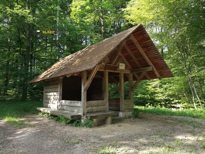
Mountain refuge Pavillon
We have it listed in the app!
We have it listed in the app!

The Pavillon refuge stands at 363 meters above sea level, overlooking the surroundings of wolfschluchtweg, kandern, hammerstein, kandern, vvg der stadt kandern, landkreis lörrach, baden-wurtemberg, 79400, alemania. It is a key spot for mountaineers looking to spend the night or take a break. Its coordinates (47.705, 7.652) place it in a strategic position for exploring the peaks and trails of the region.
14.8°C
Feels like: 13.1°C8.4 km/h
Gusts: 16.6 km/h3280 m
Snow lineUV 0
Clouds: 77% 7.6 mm
 20.1 km/h
 UV máx: 6.55
 05:33
05:33
 21:21
0.3 mm
13.4 km/h
UV máx: 6.85
05:33
21:22
0.4 mm
13.3 km/h
UV máx: 7
05:32
21:23
0 mm
13 km/h
UV máx: 6.05
05:32
21:24
1.65 mm
12 km/h
UV máx: 6.8
05:31
21:25
9 mm
16.3 km/h
UV máx: 5.85
05:31
21:25
0 mm
6 km/h
UV máx: 6.9
05:31
21:26
21:21
0.3 mm
13.4 km/h
UV máx: 6.85
05:33
21:22
0.4 mm
13.3 km/h
UV máx: 7
05:32
21:23
0 mm
13 km/h
UV máx: 6.05
05:32
21:24
1.65 mm
12 km/h
UV máx: 6.8
05:31
21:25
9 mm
16.3 km/h
UV máx: 5.85
05:31
21:25
0 mm
6 km/h
UV máx: 6.9
05:31
21:26
The surroundings of Kandern mix forest slopes, half-mountain roads and a network of trails that crosses the southwest of Baden-Württemberg, on the edge of the Black Forest and the Markgräflerland. In that context, Pavillon It appears more as a useful reference within a day on foot than as an isolated destination of high mountain: its altitude, 363 meters, places the route on a ground where the orientation between tracks, trails and small reliefs can weigh more than the height.
The location next to Wolfschluchtweg, in the end of Kandern, relates it well to routes of passage and journey. They come close to the route known as the western variant of Westweg , Markgräfler Wiiwegli , the Rheinliebe-Weg or the Interregio-Wanderweg in its German section. This gives him interest as a point of reference to order stages, link regional roads or divide a long day without depending on large levels, but a careful reading of the map and the crosses.
The nearby relief is not alpine, although it is moved enough to require a reasonable management of the effort. Cotes like Heißbühl o Munzenberg help to understand that progression can alternate forest, more open sections and continuous slope changes. In this type of terrain, fatigue often comes more from the accumulation of short, diversions and linked kilometres than from a unique and obvious rise.
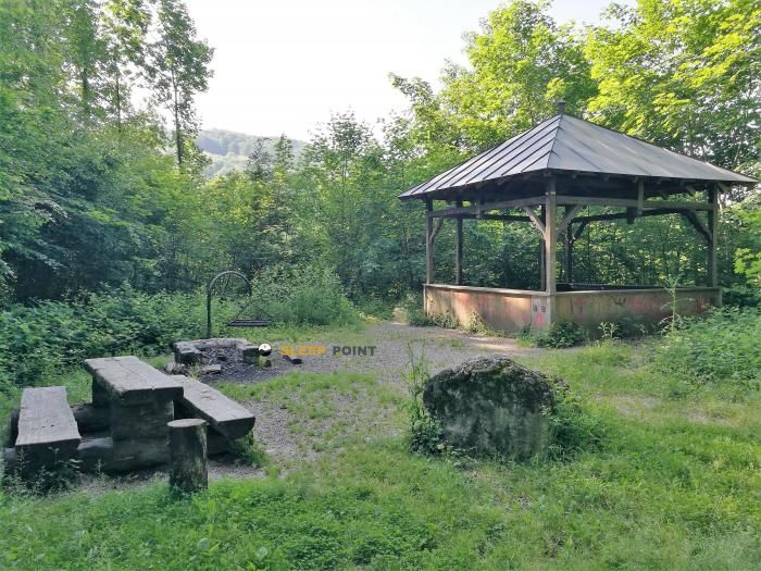
This should be considered with a conservative approach. If the idea is to use this mountain shelter as support, it is preferable not to have unconfirmed benefits or a determined logistics on the ground. It can also function as a navigation reference in an area with several signposted routes, especially when combining local paths with long-range tracks.
As for water, the nearest source is Wilhelm-Kopp-Brunnen , just over 2.3 km. This distance recommends leaving with sufficient autonomy and not taking for granted an immediate supply next to the shelter. With changing weather or long days on the Kandern road network, this forecast is more important than the altitude itself.


Download the app and start looking for the shelter of your next adventure


Find a place to sleep before night falls.