Mountain refuge Invernales de Mesones
We have it listed in the app!
We have it listed in the app!
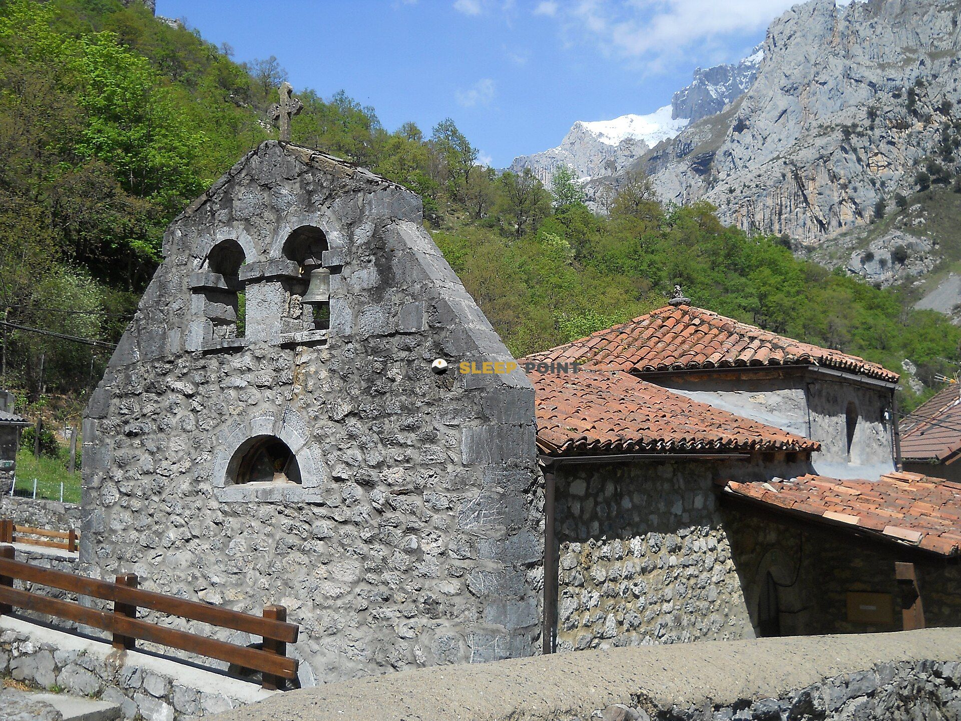

If you are planning a route through invernales de mesones, canal de mesones, caín de arriba, posada de valdeón, león, castilla y león, españa, the Invernales de Mesones refuge is a must-stop. Located at 1394 m above sea level, it offers hikers and climbers a safe place to regain strength. Save its coordinates (43.21, -4.932) in your GPS to stay on course during your journey.
10.8°C
Feels like: 10.7°C1.3 km/h
Gusts: 5 km/h4040 m
Snow lineUV 0
Clouds: 98% 16.33 mm
 5.3 km/h
 UV máx: 7.8
 06:41
06:41
 21:54
0.2 mm
8.5 km/h
UV máx: 7.7
06:40
21:55
0 mm
10.7 km/h
UV máx: 4.8
06:40
21:56
0 mm
6.5 km/h
UV máx: 8.1
06:40
21:57
6.6 mm
9.8 km/h
UV máx: 6.7
06:39
21:57
2.7 mm
6.2 km/h
UV máx: 7.8
06:39
21:58
0 mm
9.1 km/h
UV máx: 7.9
06:39
21:58
21:54
0.2 mm
8.5 km/h
UV máx: 7.7
06:40
21:55
0 mm
10.7 km/h
UV máx: 4.8
06:40
21:56
0 mm
6.5 km/h
UV máx: 8.1
06:40
21:57
6.6 mm
9.8 km/h
UV máx: 6.7
06:39
21:57
2.7 mm
6.2 km/h
UV máx: 7.8
06:39
21:58
0 mm
9.1 km/h
UV máx: 7.9
06:39
21:58
The Route of the Cares It helps to set this shelter free, but its logic is another. Invernals of Mesones is above the surroundings of Cain, in the municipality of Posada de Valdeón, within the western massif of Pics of Europe at a level of 1,394 meters that already marks a clear change of land and environment. Here the relief is organized in channels, tilted slopes and cords that link the bottom of the valley with a more rough, less linear and more conditioned mountain by the orientation.
Your interest is in supporting an area where the map weighs more than comfort. Towards the immediate environment, summits such as Pico los Cabrones , The Naughty or Tower of the Parda Canal , all very close in horizontal distance but separated by levels, channels and mountain terrain that require fine reading of the itinerary. It also fits into days that connect with signposted tours of the National Park, such as La Jocica-Carombo or the itineraries to Posada de Valdeón and Vega de Llós, although the real utility of the shelter depends more on the chosen route than on the nominal proximity of those routes. These references should not be interpreted as simple accesses or as short times.
In practical planning, water is the most sensitive factor. The nearest source is just over 2 kilometres away, so it is not wise to have immediate supply next to the shelter. For a day or a journey through this sector it is necessary to leave with sufficient autonomy and to confirm first the real state of the water points. The combination of medium altitude, relative isolation and broken ground makes this free shelter work better as a sober mountain support than as an improvised stop.


📏 3.1 Km
⛰️ 2039 m

📏 3.7 Km
⛰️ 1630 m

📏 5.2 Km
⛰️ 1231 m

📏 5.6 Km
⛰️ 1448 m

📏 5.6 Km
⛰️ 1682 m

📏 5.9 Km
⛰️ 1547 m

📏 6.1 Km
⛰️ 2041 m

📏 6.3 Km
⛰️ 1297 m
Download the app and start looking for the shelter of your next adventure


Find a place to sleep before night falls.


