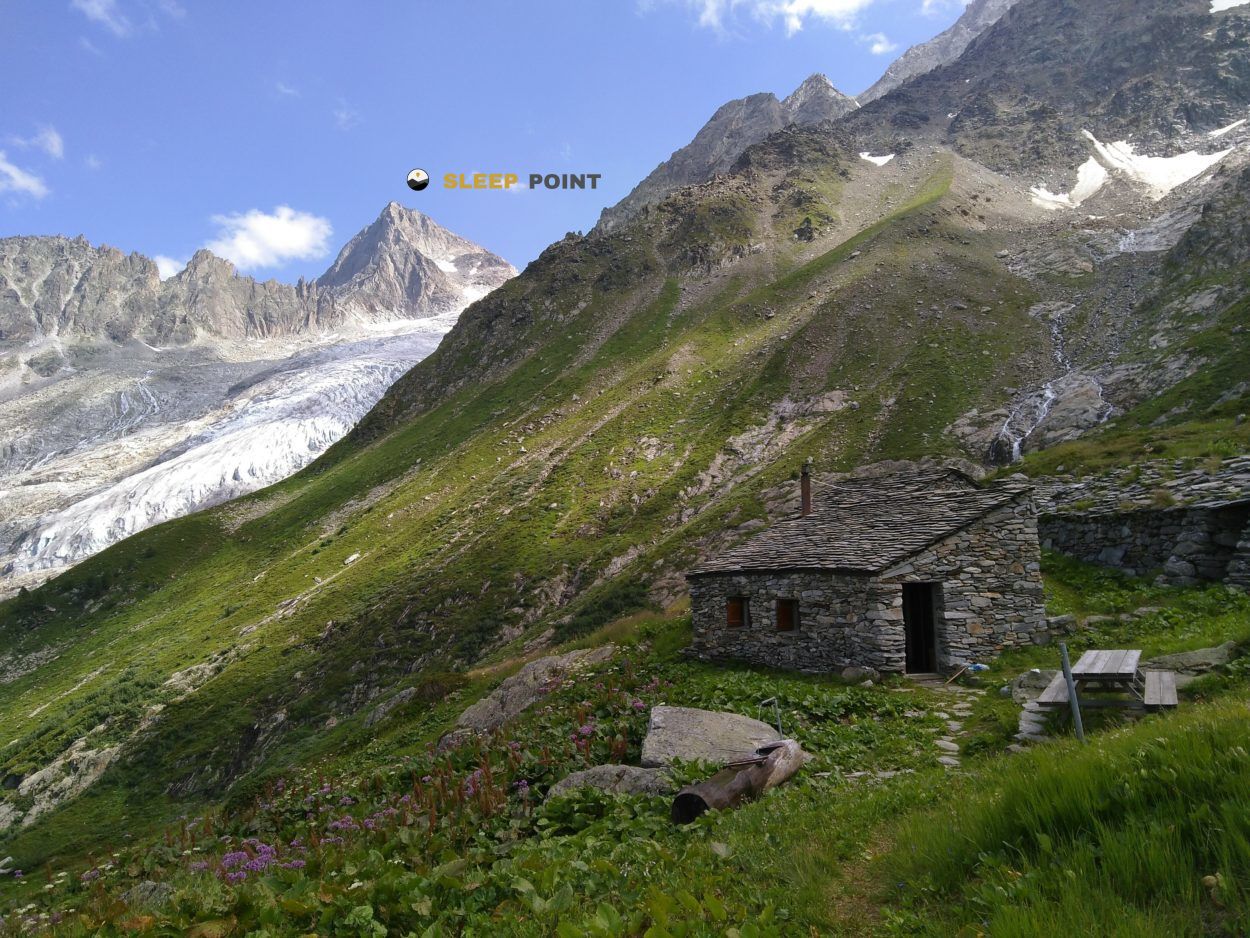
Mountain refuge Chalet La Grange
We have it listed in the app!
We have it listed in the app!


With a privileged location in 4, route du vallon, champex d'en haut, champex-lac, orsières, entremont, vallés, 1938, suiza, the Chalet La Grange refuge awaits you at 1443 meters of altitude. Note its position (46.036, 7.099) before starting your route through the mountain range or massif.
7.9°C
Feels like: 6.2°C3.1 km/h
Gusts: 10.1 km/h3940 m
Snow lineUV 0
Clouds: 51% 8.4 mm
 17.6 km/h
 UV máx: 6.85
 05:42
05:42
 21:17
1 mm
11.3 km/h
UV máx: 6
05:42
21:18
0 mm
9.5 km/h
UV máx: 6.85
05:41
21:18
0 mm
7.9 km/h
UV máx: 7.65
05:41
21:19
0.6 mm
8.2 km/h
UV máx: 6.4
05:41
21:20
5.1 mm
10.4 km/h
UV máx: 5.7
05:40
21:20
0 mm
10.6 km/h
UV máx: 7.45
05:40
21:21
21:17
1 mm
11.3 km/h
UV máx: 6
05:42
21:18
0 mm
9.5 km/h
UV máx: 6.85
05:41
21:18
0 mm
7.9 km/h
UV máx: 7.65
05:41
21:19
0.6 mm
8.2 km/h
UV máx: 6.4
05:41
21:20
5.1 mm
10.4 km/h
UV máx: 5.7
05:40
21:20
0 mm
10.6 km/h
UV máx: 7.45
05:40
21:21
In Champex d'en Haut , 1443 meters and very close to Champex-Lac , this shelter fits better in a transit logic than in a long stay. Its position in the area of Orsières, within the Valais, places it in an area where they combine long-distance routes and more serious mountain access. To plan, the most useful thing is to understand it as intermediate support, possible withdrawal point or stage cut when time changes or the day is extended.
Chalet La Grange is still low for the alpine standard of the area, but surrounded by reliefs that gain height quickly. This transition between the bottom of the inhabited valley and the most mountainous terrain is seen in the type of use: it can be used to link itineraries, reorganize a journey or lose height before entering more exposed sectors. In this environment, meteorology can close visibility and harden progression long before reaching high levels, so it is appropriate to read the day well from below and not actually give up stable conditions.
Their interest increases in the proximity of routes with continuity, such as the Via Francigena , Tour du Val de Bagnes or the Tour de la Vallée du Trient. These are not just tourist routes: they are axes of passage that allow to vary journey, shorten days or go out to other valleys. In this sense, the shelter has logistical value for those who need room for manoeuvre rather than an isolated base in the high mountain.
The next highlight helps to understand the character of the place. Summits like Le Catogne or Aiguille d'Orny they mark a clearly alpine horizon, even if the shelter is not in an extreme location. This makes it a hinge between high valley and mountain hiking with greater commitment, with changes in terrain and exposure in a short distance.
There are no immediate sources next to the shelter in the available data; the nearest ones are more than 2 kilometres away. Therefore, for a night or a journey it is necessary to leave with water autonomy and without a safe supply at the point. It is also reasonable to provide for time changes, especially if it is used as a link to long hills, summits or itineraries in the sector.


Download the app and start looking for the shelter of your next adventure


Find a place to sleep before night falls.