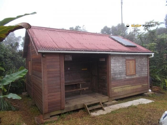
Mountain refuge Carbet de bivouac "Morne Léger"
We have it listed in the app!
We have it listed in the app!


If you are looking for total disconnection, venture into abri du morne léger, trace des alizés nord, petit-bourg, basse-terre, guadalupe, 97170, francia until you reach the Carbet de bivouac "Morne Léger" refuge, positioned at 500 meters. Use your device to navigate to the exact point (16.185, -61.732) to find this alpine shelter.
21.1°C
Feels like: 22.7°C10.8 km/h
Gusts: 29.5 km/h4960 m
Snow lineUV 0
Clouds: 9% 1.7 mm
 15.8 km/h
 UV máx: 8.95
 05:33
05:33
 18:36
2.6 mm
17.8 km/h
UV máx: 9
05:33
18:36
6.4 mm
12 km/h
UV máx: 8.25
05:33
18:37
4.5 mm
13.3 km/h
UV máx: 8.05
05:33
18:37
3 mm
16.3 km/h
UV máx: 7.5
05:34
18:37
0.9 mm
12.1 km/h
UV máx: 8.9
05:34
18:38
0.3 mm
13 km/h
UV máx: 8.7
05:34
18:38
18:36
2.6 mm
17.8 km/h
UV máx: 9
05:33
18:36
6.4 mm
12 km/h
UV máx: 8.25
05:33
18:37
4.5 mm
13.3 km/h
UV máx: 8.05
05:33
18:37
3 mm
16.3 km/h
UV máx: 7.5
05:34
18:37
0.9 mm
12.1 km/h
UV máx: 8.9
05:34
18:38
0.3 mm
13 km/h
UV máx: 8.7
05:34
18:38
Between a coat designed to make night and a simple point of passage in the middle of the mountain, Carbet de bivouac "Morne Léger" best fit as a useful reference for orientation in the network of trails of Petit-Bourg, on the island of Basse-Terre. At about 500 meters of altitude, and linked to the Trace des Alizés Nord , appears in an intermediate level where the relief already forces to read the ground well, but without entering a high mountain or alpine environment. Its value is less at the immediate summit than in the ability to order a day in an area of wet lomas, forest and rapid changes of visibility.
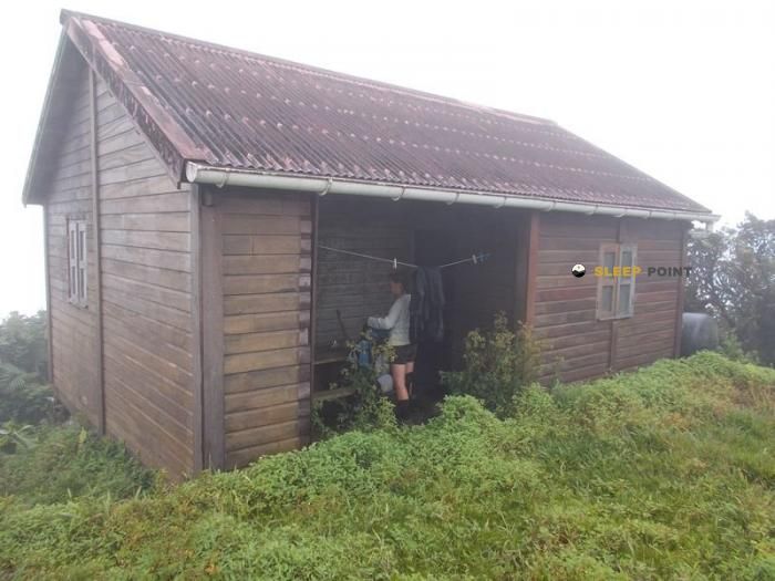
The environment Morne Léger which slightly exceeds 600 meters, helps to understand its function. It is not only a coat associated with a nearby elevation, but a practical reference within a sector with several morons and relatively close paths. In this context, the carnet can serve both to break a short journey and to support circular tours or links between itineraries of the forest area, especially to the Maison de la Forêt and other nearby tracks.
The proximity of routes such as Sentier de la Maison de la Forêt , the Mamelle de Petit Bourg or the Trace des ruisseaux suggests a space with a certain senderist transit, although this does not eliminate the need for autonomy. In tropical mountains, the orientation can be complicated by rain, mud, closed vegetation and time changes that reduce the visual reference of the relief. This coat should therefore be interpreted as logistical support and not as a guarantee of comfort or supply.
Moderate altitude should not lead to underestimated weather exposure. In Basse-Terre, the moisture, slippery soils and the intensity of the waterfalls can harden short tours on the map. If it is proposed as a basis for exploring the environment of the Morne Léger or linking with other trails, it is reasonable to provide for time limits, protection from persistent rain and attentive navigation at crosses.
There are no nearby sources in the available data, so the water should be secured from the start. It is also prudent to check the actual state of the itinerary and the coat itself before relying on it on a long day or with unstable weather.

Download the app and start looking for the shelter of your next adventure


Find a place to sleep before night falls.