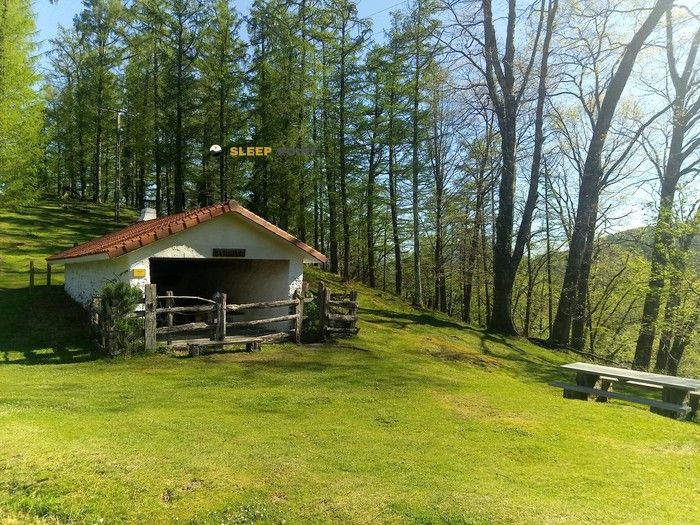
Mountain refuge Cabane du Sagasti
We have it listed in the app!
We have it listed in the app!


With a privileged location in 189260, itzeko karrika, illekueta, xantelerreka, vera de bidasoa, baztan-bidasoa, navarra, 31789, españa, the Cabane du Sagasti refuge awaits you at 291 meters of altitude. Note its position (43.3, -1.676) before starting your route through the mountain range or massif.
14.8°C
Feels like: 15.3°C0.8 km/h
Gusts: 1.8 km/h4320 m
Snow lineUV 0
Clouds: 100% 16.33 mm
 10.4 km/h
 UV máx: 1.25
 06:27
06:27
 21:42
1.7 mm
8.4 km/h
UV máx: 6.8
06:27
21:42
0.1 mm
16.3 km/h
UV máx: 4.1
06:27
21:43
0 mm
10.7 km/h
UV máx: 7.5
06:26
21:44
0.3 mm
15 km/h
UV máx: 7.65
06:26
21:44
1.5 mm
12.2 km/h
UV máx: 7.25
06:26
21:45
0 mm
9.7 km/h
UV máx: 7.35
06:26
21:46
21:42
1.7 mm
8.4 km/h
UV máx: 6.8
06:27
21:42
0.1 mm
16.3 km/h
UV máx: 4.1
06:27
21:43
0 mm
10.7 km/h
UV máx: 7.5
06:26
21:44
0.3 mm
15 km/h
UV máx: 7.65
06:26
21:44
1.5 mm
12.2 km/h
UV máx: 7.25
06:26
21:45
0 mm
9.7 km/h
UV máx: 7.35
06:26
21:46
Before you have this coat in support, you should read the ground well: Cabane du Sagasti it is only 291 meters of altitude, at a low level for the Pyrenees, but in an area where moisture, fog and rapid time changes can complicate the orientation more than its altitude suggests. Its location, in the surroundings of Bera and very close to the Ibardin border corridor, places it in a relief of lomas, forests and steps between sides, more of mountain transition than of classical high mountain.
This position gives him interest as a mountain shelter in the western Pyrenean sector, especially for those who move on long-distance routes. In its vicinity, traces are linked to the GR 10 and HRP so that it can fit as a point of protection, withdrawal or reorganisation of the day in an area where the routes link Navarra to the French side. It does not take a big gap for a stage to become demanding here: the ground broken, the crosses and the weather weigh as much as the distance.
It can also serve as a reference for exits to nearby summits of the Larrun, with Larhun relatively close and other secondary elevations around. More than an alpine base, it works better to support half-mountain routes with continuity of trails, border crossings or days in which it is interested to keep a reasonable escape path to lower levels.
On the logistical level, the presence of a fountain near the shelter, a few meters away, is a useful data in an area where water can condition autonomy if several hours of march are linked. However, in mountain it is appropriate not to take for granted the flow rate or state of the water point without recent verification.
In its context, the approach and use of the cabana require more attention to the reading of the map and the chaining of roads than to the altitude itself. It is a useful place to move between Bera, Ibardin and the border cordon environment, with practical value especially when looking for intermediate support on long routes or a withdrawal option if time is closed.


Download the app and start looking for the shelter of your next adventure


Find a place to sleep before night falls.