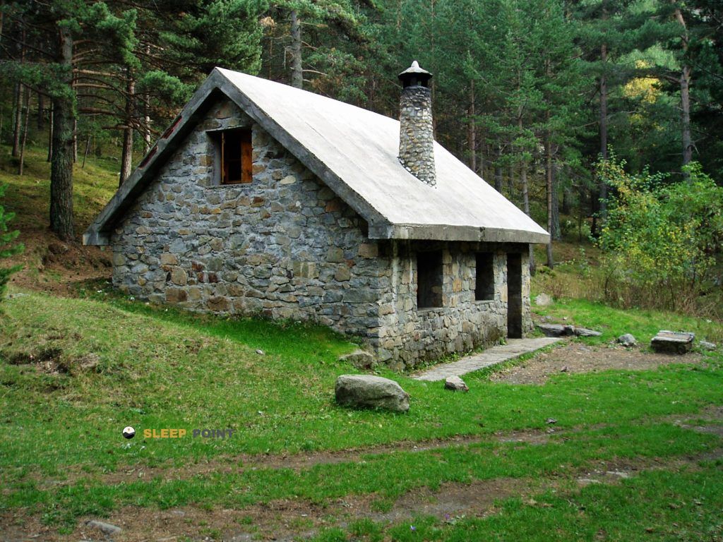
Mountain refuge Cabane de Coma
We have it listed in the app!
We have it listed in the app!


The Cabane de Coma refuge stands at 1812 meters above sea level, overlooking the surroundings of cabaña de la coma, palanca de los carboneros, benasque, ribagorza, huesca, aragón, 22440, españa. It is a key spot for mountaineers looking to spend the night or take a break. Its coordinates (42.66, 0.525) place it in a strategic position for exploring the peaks and trails of the region.
12.3°C
Feels like: 9.7°C9.3 km/h
Gusts: 16.6 km/h3520 m
Snow lineUV 1.4
Clouds: 100% 7.3 mm
 11.7 km/h
 UV máx: 5.15
 06:21
06:21
 21:31
0 mm
8.6 km/h
UV máx: 8.2
06:21
21:31
0 mm
7.4 km/h
UV máx: 7.6
06:20
21:32
0 mm
8.6 km/h
UV máx: 7.9
06:20
21:33
1.2 mm
9.5 km/h
UV máx: 8.35
06:20
21:33
3.9 mm
3.8 km/h
UV máx: 7.75
06:19
21:34
0.6 mm
6.8 km/h
UV máx: 7.95
06:19
21:35
21:31
0 mm
8.6 km/h
UV máx: 8.2
06:21
21:31
0 mm
7.4 km/h
UV máx: 7.6
06:20
21:32
0 mm
8.6 km/h
UV máx: 7.9
06:20
21:33
1.2 mm
9.5 km/h
UV máx: 8.35
06:20
21:33
3.9 mm
3.8 km/h
UV máx: 7.75
06:19
21:34
0.6 mm
6.8 km/h
UV máx: 7.95
06:19
21:35
Water and autonomy should be available from the start. In the immediate environment there are no nearby sources, and the nearest ones are several kilometres away, an important detail in a cabin of passage within open pyrenees. The summits like the Tuca d'el Dalliu , Tuca de la Stiveta de Lliterola or Pic du Maupas they draw a landscape of high slopes, crests and umbries very linked to the border sector between Aragon and France.
Cabane de Coma , at 1812 meters, it is located at the end of Benasque , by the area of the Carboneros' lever. This location is related to the mountain accesses of the north-east of the valley and to the wide framework of the Posets-Maladeta Natural Park where free shelters often function more as logistical support than as a destination in itself. Their interest is to serve as an intermediate reference in a field where isolation can be real even if there are known itineraries.
The presence of the HRP In near stages it strengthens that useful point role for long journeys, links between valleys or split days. It also fits the logic of approaches to alpine sectors related to the environment of the Perdiguero and with several nearby tucas, without the need to present it as the exclusive basis of a single ascension. More than a comfortable transit shelter, it fits better in a mountain planning where the orientation of the valley, weather and water load weigh as much as the route.
It is therefore appropriate to check the access route well before leaving and not to rely on finding immediate resources next to the cabin. If it is used within a journey or as a support to move through this sector of Benasque, it is reasonable to propose it with margin, sufficient material and a prudent reading of the ground, especially if it is linked with long routes such as the HRP or with ascends to levels that clearly exceed 2500 and 3000 meters.


📏 1.4 Km
⛰️ 1899 m

📏 1.9 Km
⛰️ 1500 m

📏 2.3 Km
⛰️ 1936 m

📏 2.6 Km
⛰️ 2035 m

📏 3 Km
⛰️ 2320 m

📏 3.6 Km
⛰️ 1895 m

📏 4.3 Km
⛰️ 1489 m
📏 4.7 Km
⛰️ 1994 m
Download the app and start looking for the shelter of your next adventure


Find a place to sleep before night falls.


