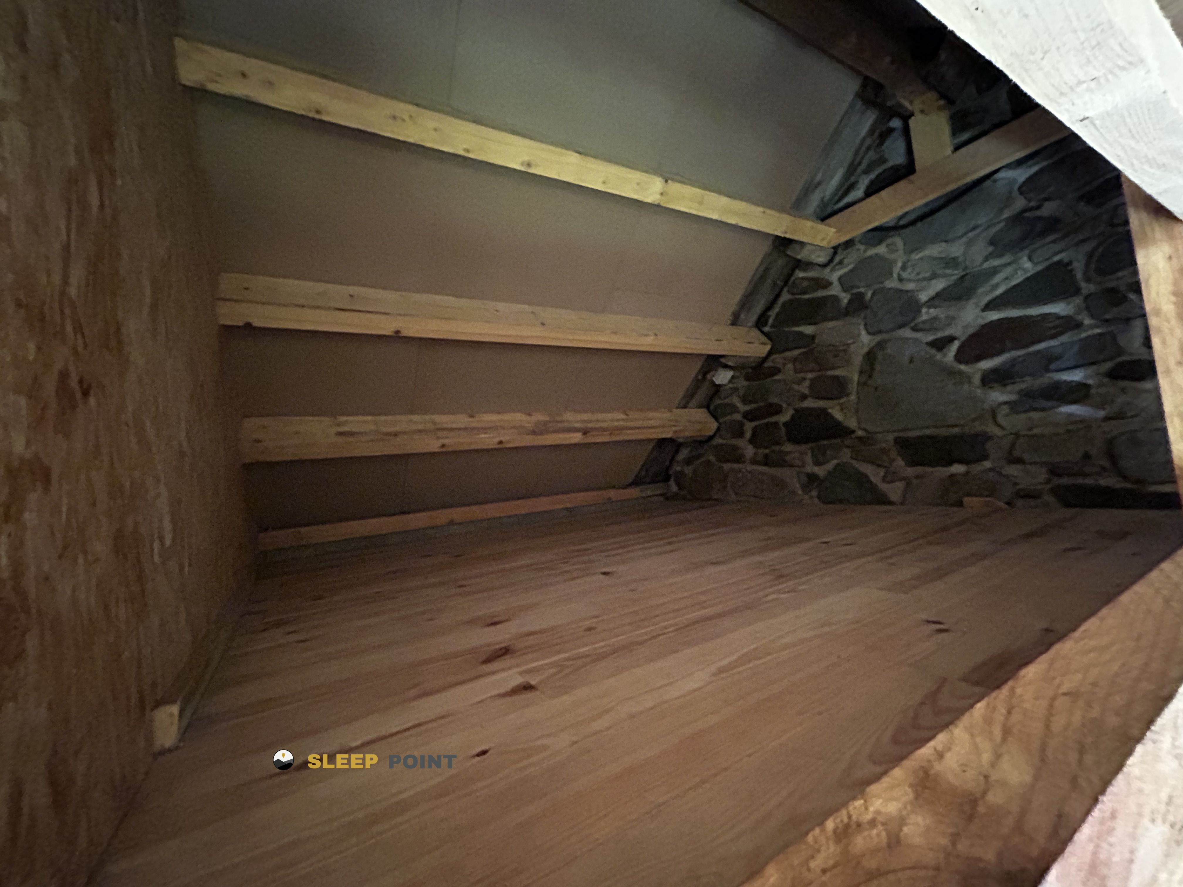
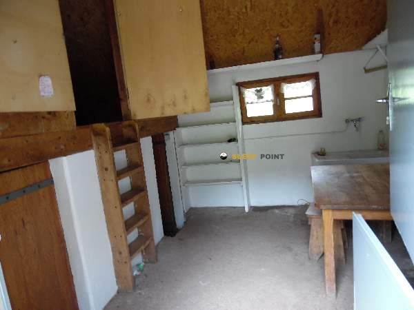
Mountain refuge Cabana de Aguas Tuertas
We have it listed in the app!
We have it listed in the app!
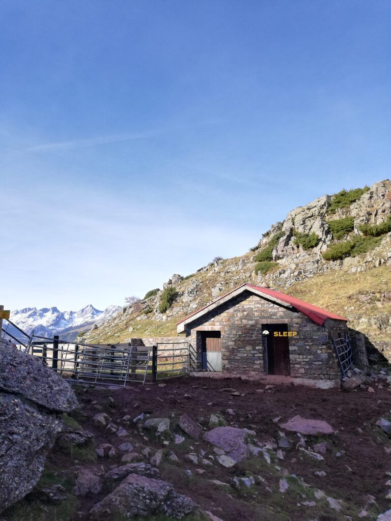

Conquering the trails of pista de aguas tuertas - gr11, ansó, la jacetania, huesca, aragón, españa is easier with the Cabana de Aguas Tuertas refuge. Located at 1615 m (coordinates 42.831, -0.629), it is the ideal shelter against harsh mountain weather.
9.5°C
Feels like: 7.7°C6.5 km/h
Gusts: 10.4 km/h4480 m
Snow lineUV 0
Clouds: 53% 7.3 mm
 12.2 km/h
 UV máx: 4.35
 06:25
06:25
 21:36
0 mm
9.8 km/h
UV máx: 8
06:25
21:37
0 mm
10.5 km/h
UV máx: 7.95
06:24
21:37
0.9 mm
12.4 km/h
UV máx: 8
06:24
21:38
0.9 mm
14.4 km/h
UV máx: 8.15
06:24
21:39
0 mm
13.6 km/h
UV máx: 5.7
06:23
21:39
0 mm
10.1 km/h
UV máx: 7.75
06:23
21:40
21:36
0 mm
9.8 km/h
UV máx: 8
06:25
21:37
0 mm
10.5 km/h
UV máx: 7.95
06:24
21:37
0.9 mm
12.4 km/h
UV máx: 8
06:24
21:38
0.9 mm
14.4 km/h
UV máx: 8.15
06:24
21:39
0 mm
13.6 km/h
UV máx: 5.7
06:23
21:39
0 mm
10.1 km/h
UV máx: 7.75
06:23
21:40
The Cabana de Aguas Torertas at 1615 m at the end of Ansó , is located in one of the most recognizable corners of the western Aragonese Pyrenees: the wide valley of Waters , a landscape of high meadows, meandros and soft lomas that contrasts with the walls and crests that close it. It is a very grateful location for those who seek a mountain day with a sense of open space and relatively intuitive orientation, especially following the axis of the valley and the paths that link with the border environment.
As a starting point, the cabin works well to propose excursions of different character. From here you can link with the Sentier d'Aguas Torertas or lengthen the day to the Tour du Lac d'Arlet , a long circular of 17.2 km that sets to combine pastures, hills and cross-border environment. It also remains in a good position to look towards nearby summits and reliefs like Punta Bisaurín (2670 m), Corner of Secus , White Cima or Souperret table , objectives that already require more gap, better land reading and more serious planning than a simple walk through the bottom of the valley.
The approach through this area is usually in comfortable terrain compared to other high mountain sectors, but it is not necessary to be trusted: the valley is open, the distances are deceiving and the wind or a sudden change of time can make the day much harder. Although there are several sources invented in the environment, they do not appear attached to the cabin, so Water should be secured before a journey or attack higher levels. On clear days it is a rather busy place by hiking, but it is enough to move away from the most obvious itineraries to recover a sense of wide, silent and very pirenaic mountain.


📏 1.5 Km
⛰️ 1986 m
📏 2 Km
⛰️ 1856 m

📏 2.4 Km
⛰️ 1877 m

📏 2.5 Km
⛰️ 1690 m

📏 2.5 Km
⛰️ 1710 m

📏 2.6 Km
⛰️ 1845 m
📏 2.7 Km
⛰️ 1800 m

📏 2.8 Km
⛰️ 1845 m
Download the app and start looking for the shelter of your next adventure


Find a place to sleep before night falls.


