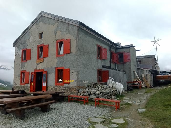
Mountain refuge Abri du Pécleret
We have it listed in the app!
We have it listed in the app!


If you are looking for total disconnection, venture into abri du pécleret, petit balcon nord, le tour, chamonix-mont-blanc, bonneville, alta saboya, auvergne-rhône-alpes, francia metropolitana, 74400, francia until you reach the Abri du Pécleret refuge, positioned at 1973 meters. Use your device to navigate to the exact point (45.991, 6.949) to find this alpine shelter.
7.6°C
Feels like: 3.8°C11.4 km/h
Gusts: 27.7 km/h3960 m
Snow lineUV 0
Clouds: 100% 16.8 mm
 25.2 km/h
 UV máx: 6.5
 05:43
05:43
 21:17
1.9 mm
13.7 km/h
UV máx: 4
05:42
21:18
0.1 mm
18.8 km/h
UV máx: 8.05
05:42
21:19
0 mm
10.5 km/h
UV máx: 8
05:42
21:20
2.1 mm
16.9 km/h
UV máx: 7.35
05:41
21:20
5.7 mm
13.1 km/h
UV máx: 2.35
05:41
21:21
0 mm
7.7 km/h
UV máx: 7.85
05:41
21:22
21:17
1.9 mm
13.7 km/h
UV máx: 4
05:42
21:18
0.1 mm
18.8 km/h
UV máx: 8.05
05:42
21:19
0 mm
10.5 km/h
UV máx: 8
05:42
21:20
2.1 mm
16.9 km/h
UV máx: 7.35
05:41
21:20
5.7 mm
13.1 km/h
UV máx: 2.35
05:41
21:21
0 mm
7.7 km/h
UV máx: 7.85
05:41
21:22
The Abri du Pécleret is located in a strategic intersection for those who travel large routes such as the Tour de la Vallée du Trient or the Chamonix-Zermatt Walker's route. In the area of the Petit Balcon Nord, near the town of Le Tour, this shelter serves as a fundamental logistical resource for the mountaineers who travel through the Chamonix-Mont-Blanc area. Its location allows to manage the effort in long days, offering a safe option before facing more exposed or technical sections.
The proximity to large reliefs defines the alpine character of this site. From its surroundings there is a direct perspective towards summits of great relevance such as the Aiguille du Tour and the Aiguille de Chardonnet, which mark the landscape of the Alta Savoy. The surrounding terrain, conditioned by the altitude of 1973 meters, has the typical characteristics of the advanced half mountain, where the vegetation begins to give way to the canchales and the proximity of the Glacier del Tour has a significant influence on the thermal conditions of the environment.
Given its position in the corral, the Abri du Pécleret functions effectively as a point of withdrawal or escape in the face of sudden weather changes. For the senderists who follow the Sentier des Alpages or head for the Aiguillette des Posettes, this shelter represents a security guarantee if conditions prevent completion of the planned stage. Assessing whether it compensates to deviate to this point is a key decision in planning, especially when tiredness or visibility compromise progress towards higher-altitude sheltered shelters.
As for logistics, autonomy is essential for overnight or rest in this coat. The water supply is not immediate, as the nearest source is located approximately 1.2 kilometres away. This separation requires users to carry out a predictable management of their water reserves before reaching the shelter. No additional services should be available, so personal equipment should be sufficient to meet night temperatures and food requirements independently.
Access from the valley requires basic guidance knowledge on mountain trails. Although the main route is well defined, the accumulation of snow in spring may make it difficult to reach the Abri du Pécleret. It is recommended to check the state of the upper steps if it is intended to use the shelter as a basis for linking with routes to the Swiss Valais. The sobriety of the installation strengthens its role as a shelter of necessity, prioritizing protection against indecency over any other comfort.


📏 1.2 Km
⛰️ 1466 m

📏 1.2 Km
⛰️ 1370 m
📏 2.3 Km
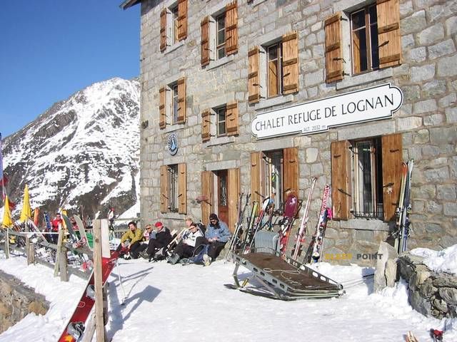
⛰️ 2032 m

📏 2.9 Km
⛰️ 1850 m

📏 3 Km
⛰️ 2706 m
📏 4.3 Km
⛰️ 2190 m

📏 4.4 Km
⛰️ 2985 m

📏 4.5 Km
⛰️ 2352 m
Download the app and start looking for the shelter of your next adventure


Find a place to sleep before night falls.


