Mountain refuge Unterstand Bettlachstock

We have it listed in the app!


            Mountain refuge Unterstand Bettlachstock in alt rüti berg stockweg, bettlach, bezirk lebern, amtei solothurn-lebern, soleura, 2544, suiza
Five orange stars in a horizontal row representing a five-star rating.

Unterstand Bettlachstock

Lat: 47.225xxx – Lon: 7.413xxx
📍 alt rüti berg stockweg, bettlach, bezirk lebern, amtei solothurn-lebern, soleura, 2544, suiza
Unterstand Bettlachstock

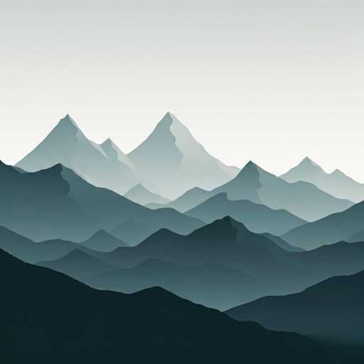
The Unterstand Bettlachstock refuge acts as a base camp for the summits and routes of alt rüti berg stockweg, bettlach, bezirk lebern, amtei solothurn-lebern, soleura, 2544, suiza. At 1242 meters of elevation, its coordinates (47.225, 7.413) represent safety after a long day of effort.

See more
See more
Usuario

Lucas Martinez

Premium user

Live weather: Unterstand Bettlachstock

At the moment, conditions in Unterstand Bettlachstock (1242m) show 9.8°C (feels like 6.3°C). Wind is blowing at 17.4 km/h with gusts up to 37.8 km/h. Today, a high of 12.5°C is expected and the freezing level is at 3870 meters.
Temperature

9.8°C

Feels like: 6.3°C
Wind

17.4 km/h

Gusts: 37.8 km/h
Freezing level 0°

3870 m

Snow line
Sky & UV

UV 0

Clouds: 100%

Next 48 hours evolution

7-day forecast

04/06
12.5° 7.7°
21.1 mm 25.1 km/h UV máx: 5.7
05:36 21:20
05/06
10.7° 6.1°
5 mm 19.4 km/h UV máx: 5.3
05:36 21:21
06/06
16.2° 7.1°
0.1 mm 15.6 km/h UV máx: 7.15
05:35 21:22
07/06
16.5° 8.3°
0 mm 12.4 km/h UV máx: 6.55
05:35 21:23
08/06
18.8°
2.55 mm 9.5 km/h UV máx: 6.95
05:34 21:24
09/06
14.4°
6.9 mm 12.3 km/h UV máx: 3.65
05:34 21:24
10/06
16.3° 5.6°
0 mm 15.2 km/h UV máx: 7.05
05:34 21:25

On the slope of Bettlachstock At 1,242 metres, this free shelter is left in an area where changes in orientation have a great influence on progression. The nearby relief alternates sections of forest and crest, with very close references such as Wandflue and Bettlachstock itself, so it does not only work as a spot coat: it also fits as an intermediate point to reorganize the day, shorten a journey or withdraw to lower levels if the weather gets worse.

Its position, on the surroundings of Bettlach and in the canton of Soleura, places it in a mountain of medium altitude very long walking, but with sufficient emphasis to demand attention in crosses, side changes and reading of the terrain. The closeness of the European itinerary E4 and local routes such as Wurzelweg It strengthens this role of logistical support rather than of an isolated destination. In this sector, moving from one side to another can change the exposure to the wind, soil moisture or visibility, something relevant when linking cords or looking for a quick exit to lower tracks and roads.

To plan with autonomy, the most useful data is water: there is a source at about 270 meters and several more within the first kilometre, which reduces the dependence on loading everything from the valley, although it is always necessary to have room and not to make sure its availability at any time. As in any free shelter, it is prudent to arrive with sufficient equipment, light, shelter and ability to resolve a change of plan without external support. More than a remote high mountain shelter, this coat makes sense as a practical resource in a passing area, with several options of continuation and also escape.

Hiking routes from the refuge

Local

Gänsbrunnen - Siky-Ranch

↔ Variable distance
E4

European long distance path E4 - part Switzerland

↔ Variable distance
Local

Wurzelweg

↔ 4.5 km
Local

Montagne de Romont-Plagne

↔ Variable distance
Local

Romont - fixme

↔ Variable distance
Local

Althüsli - Chessel

↔ Variable distance
Local

Gsäss - Egg

↔ Variable distance
Local

Glaserweg - fixme

↔ Variable distance

Nearby peaks

Hasenmatt

1445 m
Lat: 47.2422 Lon: 7.451

Gitziflue

1329 m
Lat: 47.2437 Lon: 7.4714

Gäschlerflue

943 m
Lat: 47.2172 Lon: 7.4021

Bettlachstock

1298 m
Lat: 47.228 Lon: 7.4126

Wandflue

1399 m
Lat: 47.2327 Lon: 7.41

Grenchenberg

1405 m
Lat: 47.2296 Lon: 7.3836

Stallflue

1409 m
Lat: 47.2383 Lon: 7.4334

Bürenchopf

1263 m
Lat: 47.2194 Lon: 7.3485

Nearby water fountains

Fuente

273 m
Lat: 47.2194 Lon: 7.3485

Fuente

623 m
Lat: 47.2194 Lon: 7.3485

Fuente

792 m
Lat: 47.2194 Lon: 7.3485

Fuente

816 m
Lat: 47.2194 Lon: 7.3485

Fuente

890 m
Lat: 47.2194 Lon: 7.3485

Fuente

1 Km
Lat: 47.2194 Lon: 7.3485

Fuente

1.08 Km
Lat: 47.2194 Lon: 7.3485

Fuente

1.17 Km
Lat: 47.2194 Lon: 7.3485
FAQ

Frequently asked questions

Pregunta frecuente
What are the GPS coordinates of the Unterstand Bettlachstock refuge?
To locate the Unterstand Bettlachstock refuge on your GPS or map, use the following coordinates: Latitude 47.225 and Longitude 7.413.
Pregunta frecuente
Is it necessary to carry a GPS to reach the Unterstand Bettlachstock refuge?
It is always highly recommended to carry a GPS device, a route track, or a topographic map in the mountains. You can use the coordinates 47.225, 7.413 to locate this refuge precisely.
Pregunta frecuente
In which municipality or region is the Unterstand Bettlachstock refuge located?
This refuge is located within the municipality of Bettlach, belonging to the community or region of Soleura.
More areas

Other areas

Collaborative

Together we improve

image

Send your photos

You can upload photos of shelters and update their status so other users know if they can go there.

Get started
Get started
image

Rate the shelter

Leave your comments to rate the shelter’s condition. In the mountains, we look after each other.

Get started
Get started
image

Add new ones

Did we miss any? Publish the shelters you know so everyone can use them.

Get started
Get started
Download for free from the Apple App Store and Play Store.

Download the app and start looking for the shelter of your next adventure

Aplicación móvil para encontrar refugios de montaña donde dormir
Aplicación móvil para encontrar refugios de montaña donde dormir.
Mapa interactivo de refugios de montaña en los Pirineos dentro de la app
Mapa de refugios de montaña para senderismo y trekking en la app.
Pantalla con información de refugio de montaña con altitud capacidad y servicios
Pantalla con información de refugio de montaña con altitud capacidad y servicios.
Detalles de refugio de montaña con servicios y meteorología en aplicación móvil
Detalles de refugio de montaña con servicios y meteorología en aplicación móvil.
Aplicación para explorar refugios de montaña mediante mapa interactivo
Aplicación para explorar refugios de montaña mediante mapa interactivo.
Ficha completa de refugio de montaña con opiniones y servicios
Ficha completa de refugio de montaña con opiniones y servicios.
Información detallada de refugio en app para montañeros
Información detallada de refugio en app para montañeros.
Listado de refugios de montaña para senderismo y trekking
Listado de refugios de montaña para senderismo y trekking.
Explorar refugios de montaña desde una aplicación móvil
Explorar refugios de montaña desde una aplicación móvil.