Mountain refuge Refuge du fond d'Aussois
We have it listed in the app!
We have it listed in the app!
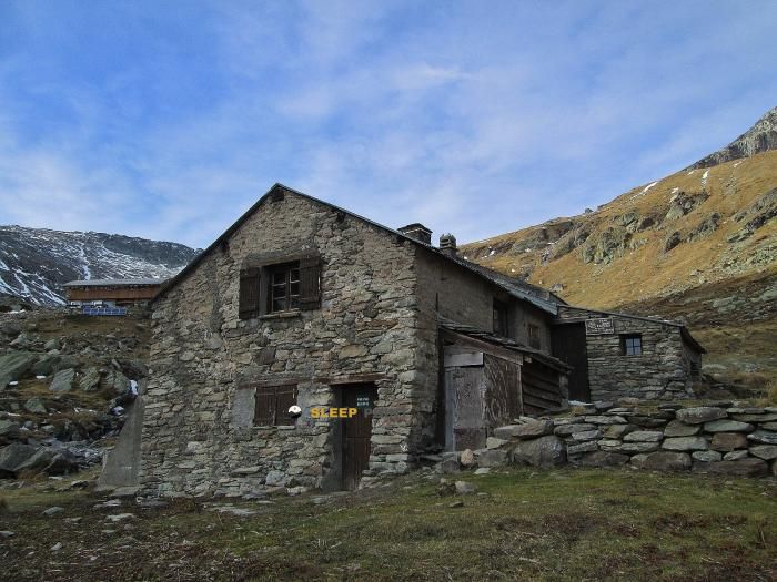

The mountains of sentier du lac du génépy, aussois, saint-jean-de-maurienne, saboya, auvergne-rhône-alpes, francia metropolitana, 73500, francia hide essential places like the Refuge du fond d'Aussois refuge. Situated at an elevation of 2338 meters, it offers protection and rest. Its exact coordinates are 45.277, 6.702.
6°C
Feels like: 2.6°C2.6 km/h
Gusts: 5.8 km/h4060 m
Snow lineUV 0
Clouds: 95% 23 mm
23 mm
 25.1 km/h
 UV máx: 6.7
 05:47
05:47
 21:15
0.9 mm
18.7 km/h
UV máx: 7.85
05:46
21:16
0 mm
18.2 km/h
UV máx: 8.15
05:46
21:17
0 mm
10.7 km/h
UV máx: 8.1
05:46
21:18
0.9 mm
13.7 km/h
UV máx: 7.95
05:45
21:18
0 mm
13.7 km/h
UV máx: 5.3
05:45
21:19
0 mm
11.1 km/h
UV máx: 7.75
05:45
21:19
21:15
0.9 mm
18.7 km/h
UV máx: 7.85
05:46
21:16
0 mm
18.2 km/h
UV máx: 8.15
05:46
21:17
0 mm
10.7 km/h
UV máx: 8.1
05:46
21:18
0.9 mm
13.7 km/h
UV máx: 7.95
05:45
21:18
0 mm
13.7 km/h
UV máx: 5.3
05:45
21:19
0 mm
11.1 km/h
UV máx: 7.75
05:45
21:19
At the top of the term of You're missing. already in a clearly alpine environment and at 2338 metres, the Refuge du fond d'Aussis is attached to a valley header where the relief gains height quickly. The proximity of summits such as Grand Roc or Pointe de l'Observatoire helps to understand its function: not so much as an obvious stop of passage on a route pointed out here, but as a support to move on mountain terrain where the orientation and state of the day make progress very difficult.
By its position, this shelter is especially useful for those who propose a long day and prefer to split it, or for those who need an intermediate point before gaining height to the higher circus. It also fits into exits where the schedule is delayed, the meteor forces not to extend the day too long, or the fatigue advises to ensure a coat before continuing to higher levels. In this type of land, small changes in orientation within the valley can be translated into colder slopes, late nevers or more exposed sections to the wind.
The access is made by mountain path, in an environment where it is necessary to have autonomy and reading of the land. There are no data here to describe closed routes or specific links between sides, so planning should be done with updated mapping and references. Its location in Savoy, within Auvernia-Rhódano-Alpes, places it in a very mountainous area, but that alone does not imply simple tours or clear continuity of the route in height.
In immediate logistics, the most relevant data is the presence of sources very close to the shelter, a few meters away, something valuable to manage water during the approach or when reorganizing a day. However, in high mountains it is appropriate to check the actual flow and conditions before relying on this resource, especially if the plan includes continuing above the valley bottom or linking more isolated land.


📏 1.5 Km
⛰️ 2511 m

📏 2.2 Km
⛰️ 2358 m

📏 3.1 Km
⛰️ 2320 m
📏 3.7 Km
⛰️ 2474 m

📏 5.7 Km
⛰️ 1911 m

📏 5.8 Km
⛰️ 1985 m

📏 6.7 Km
⛰️ 1483 m

📏 7.5 Km
⛰️ 2190 m
Download the app and start looking for the shelter of your next adventure


Find a place to sleep before night falls.


