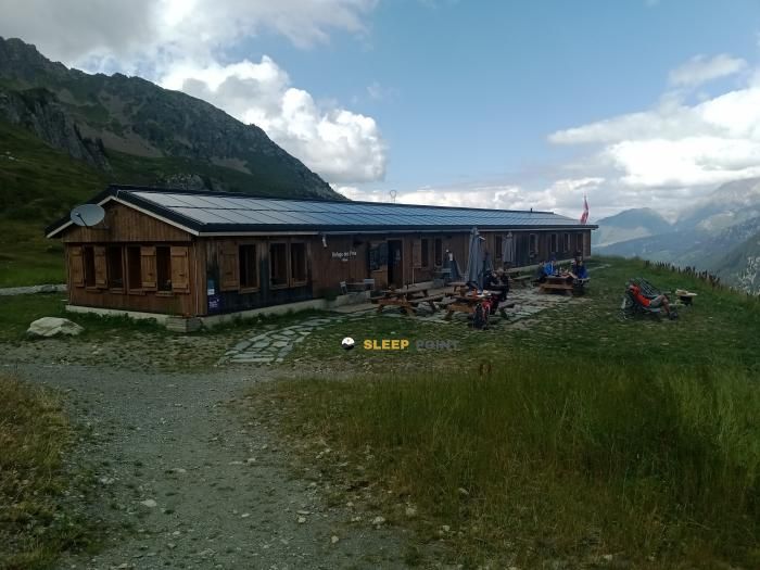
Mountain refuge Refuge de la Balme
We have it listed in the app!
We have it listed in the app!

Protected by the wild surroundings of refuge de la balme, ancienne route nationale 202, les contamines-montjoie, bonneville, alta saboya, auvergne-rhône-alpes, francia metropolitana, 74170, francia, the Refuge de la Balme refuge is your best ally at 1706 meters of elevation. Once you reach its coordinates (45.758, 6.711), you can enjoy a well-deserved mountain rest.
6.4°C
Feels like: 2.8°C9.7 km/h
Gusts: 20.5 km/h4010 m
Snow lineUV 0
Clouds: 72% 34 mm
34 mm
 9.5 km/h
 UV máx: 5.95
 05:45
05:45
 21:17
1.4 mm
10.1 km/h
UV máx: 6.5
05:44
21:18
0 mm
11.3 km/h
UV máx: 7.85
05:44
21:19
0 mm
9.3 km/h
UV máx: 7.8
05:43
21:20
1.65 mm
14.2 km/h
UV máx: 6.95
05:43
21:20
8.1 mm
10 km/h
UV máx: 5.6
05:43
21:21
0 mm
8.7 km/h
UV máx: 7.7
05:43
21:22
21:17
1.4 mm
10.1 km/h
UV máx: 6.5
05:44
21:18
0 mm
11.3 km/h
UV máx: 7.85
05:44
21:19
0 mm
9.3 km/h
UV máx: 7.8
05:43
21:20
1.65 mm
14.2 km/h
UV máx: 6.95
05:43
21:20
8.1 mm
10 km/h
UV máx: 5.6
05:43
21:21
0 mm
8.7 km/h
UV máx: 7.7
05:43
21:22
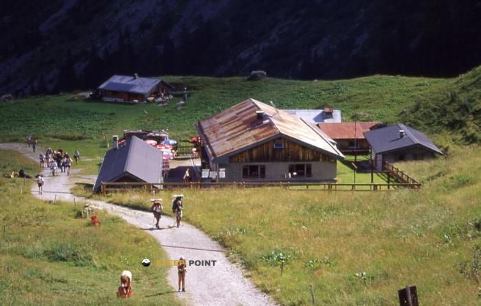
At the head of Les Contamines- Montjoie , this shelter appears in a very recognizable area of passage for those who plan alpine traverses: this is where variants of the Tour du Mont Blanc and tours that look towards the Beaufortain so that its function fits either as intermediate support in long days or as a reference for reorganizing the route according to the terrain and the weather. At 1706 meters, the atmosphere is already clearly montane, although still in a strip where the relief combines high pastures, open slopes and access to more mineral sectors as it gains height.
The environment is in a useful position to read the mountain before entering higher ground. Up, the presence of tops like Tête de la Cicle or Mont Tondu helps to understand the character of the area: a relief that passes from undulating to more alpine in a short distance, with changes in orientation that can influence progression, especially when they are linked to hills or enter more exposed slopes. In this context, the shelter not only serves as a point of rest, but also as a practical reference for sharing effort in the approach and avoiding excessive lengthening of a day that then continues towards high steps.
For basic logistics, the proximity of the Source du bonhomme , just a few meters, is a relevant data, and there is also another source somewhat below, in the sector of Fontaine sous la Balme . However, in road planning it is necessary to maintain a margin of autonomy and always verify the actual conditions of the water and the route. In an area with a lot of traffic, but with growing demand as soon as the valley bottom is left, this type of mountain shelter is particularly useful for those who need a clear reference between access from Les Polimines and the routes that go into higher sectors of the massif.


📏 0.8 Km
⛰️ 1920 m
📏 1 Km
⛰️ 1935 m

📏 2.3 Km
⛰️ 1459 m

📏 2.5 Km
⛰️ 2329 m

📏 2.9 Km
⛰️ 2695 m

📏 3 Km
⛰️ 1873 m

📏 4 Km
⛰️ 2443 m

📏 4.2 Km
⛰️ 1970 m
Download the app and start looking for the shelter of your next adventure


Find a place to sleep before night falls.


