Mountain refuge Orri de Monsieur Hullo

We have it listed in the app!


            Mountain refuge Orri de Monsieur Hullo in orri de monsieur hullo, ancien chemin de l'eau, sansa, prades, pirineos orientales, occitania, francia metropolitana, 66360, francia
Five orange stars in a horizontal row representing a five-star rating.

Orri de Monsieur Hullo

Lat: 42.613xxx – Lon: 2.159xxx
📍 orri de monsieur hullo, ancien chemin de l'eau, sansa, prades, pirineos orientales, occitania, francia metropolitana, 66360, francia
Orri de Monsieur Hullo

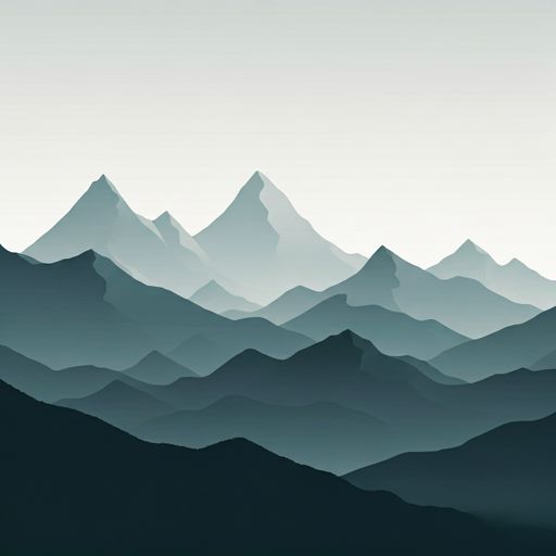
Prepare your backpack and head to orri de monsieur hullo, ancien chemin de l'eau, sansa, prades, pirineos orientales, occitania, francia metropolitana, 66360, francia. There you will find the Orri de Monsieur Hullo refuge at 1653 meters of elevation. An essential stop along the way (Lat: 42.613, Lon: 2.159) for any mountain enthusiast.

See more
See more
Usuario

Lucas Martinez

Premium user

Live weather: Orri de Monsieur Hullo

At the moment, conditions in Orri de Monsieur Hullo (1653m) show 9.1°C (feels like 7.9°C). Wind is blowing at 7.1 km/h with gusts up to 4.3 km/h. Today, a high of 17.6°C is expected and the freezing level is at 4270 meters.
Temperature

9.1°C

Feels like: 7.9°C
Wind

7.1 km/h

Gusts: 4.3 km/h
Freezing level 0°

4270 m

Snow line
Sky & UV

UV 0.4

Clouds: 98%

Next 48 hours evolution

7-day forecast

04/06
17.6° 6.1°
20.6 mm 25.8 km/h UV máx: 5.15
06:15 21:24
05/06
11° 3.3°
0.4 mm 20.6 km/h UV máx: 7.95
06:14 21:25
06/06
16.2° 6.7°
0 mm 7.9 km/h UV máx: 6.65
06:14 21:25
07/06
20.3° 8.5°
0.4 mm 8.3 km/h UV máx: 7.05
06:14 21:26
08/06
22.2° 11.7°
5.1 mm 9 km/h UV máx: 7.55
06:13 21:27
09/06
15.2° 5.8°
2.4 mm 7.9 km/h UV máx: 7.05
06:13 21:27
10/06
17.5° 4.8°
0.6 mm 8.3 km/h UV máx: 7.8
06:13 21:28

Open ladders, medium and high mountain relief and a network of roads linking the Conflent with the high sectors of the Caprir draw the environment of Orri de Monsieur Hullo , in the term of Sansa, within the Eastern Pyrenees. At 1,653 metres, this coat fits better as basic support on mountain grounds than as a destination in itself: it serves to order progression in an area where the map and orientation of the itinerary weigh more than the presence of services.

Their practical interest appears mainly in planning long days or in seeking an intermediate point of withdrawal. In this sector they pass variable routes such as Chemin Vauban and Tour du Capcir , in addition to the PR31 of Les rhododendrons, which suggests connection between sides and possibilities to link roads without depending on a single climb and down. It also remains under reliefs such as the Puig d'Escoutou, the Pic de la Socarrada or the Roc de Nou Fonts, useful references to understand the mountainous character of the environment, although it is not appropriate to translate that automatically into simple ascension.

In terms of logistics, the most important point is autonomy. The nearest registered source, Fontaine Sainte-Marie, is about 2.8 km away, so it is not reasonable to have immediate water next to the shelter. For a road planning It is wise to go out with sufficient water and to expect that weather, fog or a change of pace in mountain terrain can make the day long enough.

As with many mountain shelters of this type, their real utility depends on the fit within the itinerary: divide stage, cover a retreat or have a support point in an unequipped area. Before leaving, it is worth reviewing mapping, descending alternatives and general state of the journey, especially if you plan to link several paths on the same day.

Hiking routes from the refuge

Local

Chemin Vauban

↔ Variable distance
PR31

Les rhododendrons

↔ 7 km
Local

Tour du Capcir

↔ Variable distance
CC-C

El Camí IT1TR4 El Camí Capçaler: de Salzes a Balaguer

↔ Variable distance
CC-C

El Camí IT1TR5 El Camí Capçaler: de Salzes a Balaguer

↔ Variable distance

Nearby peaks

Puig d'Escoutou

2292 m
Lat: 42.6155 Lon: 2.2107

Pic de la Socarrada

2006 m
Lat: 42.5732 Lon: 2.1497

Roc de Nou Fonts

2333 m
Lat: 42.6541 Lon: 2.1805

Roc Mary

Altitude not available
Lat: 42.6528 Lon: 2.1694

Roc Negre

2450 m
Lat: 42.6513 Lon: 2.2015

Salt del Burro

Altitude not available
Lat: 42.6572 Lon: 2.1977

El Roc Gros

Altitude not available
Lat: 42.6025 Lon: 2.1558

Pic de Caputxet

2013 m
Lat: 42.5694 Lon: 2.1285

Nearby water fountains

Fontaine Sainte-Marie

2.8 Km
Lat: 42.5694 Lon: 2.1285

Fuente

3.5 Km
Lat: 42.5694 Lon: 2.1285

Font del Salze

3.53 Km
Lat: 42.5694 Lon: 2.1285

Fuente

3.59 Km
Lat: 42.5694 Lon: 2.1285

Robinet du cimetière

4.41 Km
Lat: 42.5694 Lon: 2.1285

Fuente

4.63 Km
Lat: 42.5694 Lon: 2.1285

Fuente

4.73 Km
Lat: 42.5694 Lon: 2.1285

Fuente

4.8 Km
Lat: 42.5694 Lon: 2.1285
FAQ

Frequently asked questions

Pregunta frecuente
Is it necessary to carry a GPS to reach the Orri de Monsieur Hullo refuge?
It is always highly recommended to carry a GPS device, a route track, or a topographic map in the mountains. You can use the coordinates 42.613, 2.159 to locate this refuge precisely.
Pregunta frecuente
In which municipality or region is the Orri de Monsieur Hullo refuge located?
This refuge is located within the municipality of Sansa, belonging to the community or region of Occitania.
Pregunta frecuente
Are there other mountain refuges near Orri de Monsieur Hullo?
Yes, nearby you can find other options to spend the night or take shelter. El refugio más próximo es el Orri du Pla de l'orri, que se encuentra a aproximadamente 0.6 km de distancia.
More areas

Other areas

Collaborative

Together we improve

image

Send your photos

You can upload photos of shelters and update their status so other users know if they can go there.

Get started
Get started
image

Rate the shelter

Leave your comments to rate the shelter’s condition. In the mountains, we look after each other.

Get started
Get started
image

Add new ones

Did we miss any? Publish the shelters you know so everyone can use them.

Get started
Get started
Download for free from the Apple App Store and Play Store.

Download the app and start looking for the shelter of your next adventure

Aplicación móvil para encontrar refugios de montaña donde dormir
Aplicación móvil para encontrar refugios de montaña donde dormir.
Mapa interactivo de refugios de montaña en los Pirineos dentro de la app
Mapa de refugios de montaña para senderismo y trekking en la app.
Pantalla con información de refugio de montaña con altitud capacidad y servicios
Pantalla con información de refugio de montaña con altitud capacidad y servicios.
Detalles de refugio de montaña con servicios y meteorología en aplicación móvil
Detalles de refugio de montaña con servicios y meteorología en aplicación móvil.
Aplicación para explorar refugios de montaña mediante mapa interactivo
Aplicación para explorar refugios de montaña mediante mapa interactivo.
Ficha completa de refugio de montaña con opiniones y servicios
Ficha completa de refugio de montaña con opiniones y servicios.
Información detallada de refugio en app para montañeros
Información detallada de refugio en app para montañeros.
Listado de refugios de montaña para senderismo y trekking
Listado de refugios de montaña para senderismo y trekking.
Explorar refugios de montaña desde una aplicación móvil
Explorar refugios de montaña desde una aplicación móvil.