Mountain refuge Jasse du Pont de Fer

We have it listed in the app!


            Mountain refuge Jasse du Pont de Fer in jasse du pont de fer, sentier de chasseurs, camplong, béziers, hérault, occitania, francia metropolitana, 34260, francia
Five orange stars in a horizontal row representing a five-star rating.

Jasse du Pont de Fer

Lat: 43.69xxx – Lon: 3.127xxx
📍 jasse du pont de fer, sentier de chasseurs, camplong, béziers, hérault, occitania, francia metropolitana, 34260, francia
Jasse du Pont de Fer

Discover the vastness of jasse du pont de fer, sentier de chasseurs, camplong, béziers, hérault, occitania, francia metropolitana, 34260, francia by spending the night at the Jasse du Pont de Fer refuge. It sits at 426 meters, offering a unique balcony over the natural landscape. Find it on the map at latitude 43.69 and longitude 3.127.

See more
See more
Usuario

Lucas Martinez

Premium user

Live weather: Jasse du Pont de Fer

At the moment, conditions in Jasse du Pont de Fer (426m) show 15.3°C (feels like 14.6°C). Wind is blowing at 4.5 km/h with gusts up to 14.8 km/h. Today, a high of 22.5°C is expected and the freezing level is at 4360 meters.
Temperature

15.3°C

Feels like: 14.6°C
Wind

4.5 km/h

Gusts: 14.8 km/h
Freezing level 0°

4360 m

Snow line
Sky & UV

UV 0

Clouds: 100%

Next 48 hours evolution

7-day forecast

04/06
22.5° 13.2°
8.5 mm 26.5 km/h UV máx: 5.35
06:07 21:24
05/06
20.6° 10.7°
0 mm 24.5 km/h UV máx: 7.25
06:07 21:25
06/06
25.4° 11.4°
0 mm 16.3 km/h UV máx: 7.55
06:06 21:25
07/06
26.6° 14.9°
0 mm 9.9 km/h UV máx: 7
06:06 21:26
08/06
25.9° 15.9°
0.45 mm 13.2 km/h UV máx: 7.5
06:06 21:27
09/06
22.6° 15.7°
0 mm 26.4 km/h UV máx: 6.9
06:05 21:27
10/06
27.3° 12.8°
0 mm 11.5 km/h UV máx: 7.35
06:05 21:28

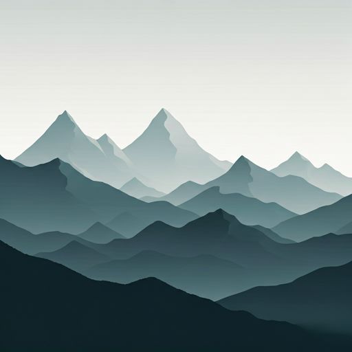
In this sector of Occitania , the coat works more as a resource of passage and tactical support than as a place where it is appropriate to trust all the logistics. The Jasse du Pont de Fer in the surroundings of Camplong and at 426 meters, is linked to routes of continuity such as GR 7 and GR 71 , so that it can be used to break a day or to link tours between looms, rails and low mountain of the Haut-Languedoc. It is not a high-mountain pirenaic site, but it is a useful point in wavy terrain and exposed to rhythm changes, where orientation and autonomy remain important.

Its mountain interest is mainly in the immediate elevations: Cap Nègre It appears very close, and also remain by hand reliefs such as Mont Méguillou or Mont des trois terres, which help to understand the character of the land, more of crest and linked hills than of comfortable valley. To propose the day it is necessary to think of the access of the senderist with variable sections according to the chosen itinerary, without giving for fact water next to the shelter: the nearest registered source is about 2 km, sufficient distance to demand foresight. If it is used as a support on the journey or in a short exit on the nearby tops, it is reasonable to arrive with margin, with clear navigation and without depending on finding immediate resources in the coat itself.

Hiking routes from the refuge

PR

L'Arboretum de l'Espaze

↔ Variable distance
GR 71

De l'Espérou (Gard) au col de Fontfroide (Hérault)

↔ Variable distance
GRP HLV

Tours dans le Pays Haut Languedoc et Vignobles

↔ Variable distance
GR 7

Des Vosges aux Pyrénées 05, Prat Peyrot - Boussagues

↔ Variable distance
GR 7

Des Vosges aux Pyrénées 06, Boussagues - Col de Fontfroide

↔ Variable distance
GR 787

Chemin de Fontcaude

↔ Variable distance
PR

La Haute Vallée de la Mare

↔ Variable distance
PR

Les Orgues de Taussac

↔ Variable distance

Nearby peaks

Roc Mendic

Altitude not available
Lat: 43.713 Lon: 3.1346

Mont Blacarede

Altitude not available
Lat: 43.7151 Lon: 3.1332

Cap Nègre

677 m
Lat: 43.6844 Lon: 3.1297

Mont Méguillou

786 m
Lat: 43.7007 Lon: 3.1374

Mont des trois terres

706 m
Lat: 43.7036 Lon: 3.1326

Mont Agut

1022 m
Lat: 43.7032 Lon: 3.0613

Pic de la Caumette

772 m
Lat: 43.6927 Lon: 3.097

Les Prades

590 m
Lat: 43.6525 Lon: 3.0975

Nearby water fountains

Fuente

2 Km
Lat: 43.6525 Lon: 3.0975

Fuente

2.06 Km
Lat: 43.6525 Lon: 3.0975

Fuente

2.8 Km
Lat: 43.6525 Lon: 3.0975

Fuente

2.97 Km
Lat: 43.6525 Lon: 3.0975

Fuente

3.27 Km
Lat: 43.6525 Lon: 3.0975

Fuente

3.38 Km
Lat: 43.6525 Lon: 3.0975

Fuente

4.08 Km
Lat: 43.6525 Lon: 3.0975

Fuente

4.26 Km
Lat: 43.6525 Lon: 3.0975
FAQ

Frequently asked questions

Pregunta frecuente
What are the GPS coordinates of the Jasse du Pont de Fer refuge?
To locate the Jasse du Pont de Fer refuge on your GPS or map, use the following coordinates: Latitude 43.69 and Longitude 3.127.
Pregunta frecuente
Is it necessary to carry a GPS to reach the Jasse du Pont de Fer refuge?
It is always highly recommended to carry a GPS device, a route track, or a topographic map in the mountains. You can use the coordinates 43.69, 3.127 to locate this refuge precisely.
Pregunta frecuente
In which municipality or region is the Jasse du Pont de Fer refuge located?
This refuge is located within the municipality of Camplong, belonging to the community or region of Occitania.
More areas

Other areas

Collaborative

Together we improve

image

Send your photos

You can upload photos of shelters and update their status so other users know if they can go there.

Get started
Get started
image

Rate the shelter

Leave your comments to rate the shelter’s condition. In the mountains, we look after each other.

Get started
Get started
image

Add new ones

Did we miss any? Publish the shelters you know so everyone can use them.

Get started
Get started
Download for free from the Apple App Store and Play Store.

Download the app and start looking for the shelter of your next adventure

Aplicación móvil para encontrar refugios de montaña donde dormir
Aplicación móvil para encontrar refugios de montaña donde dormir.
Mapa interactivo de refugios de montaña en los Pirineos dentro de la app
Mapa de refugios de montaña para senderismo y trekking en la app.
Pantalla con información de refugio de montaña con altitud capacidad y servicios
Pantalla con información de refugio de montaña con altitud capacidad y servicios.
Detalles de refugio de montaña con servicios y meteorología en aplicación móvil
Detalles de refugio de montaña con servicios y meteorología en aplicación móvil.
Aplicación para explorar refugios de montaña mediante mapa interactivo
Aplicación para explorar refugios de montaña mediante mapa interactivo.
Ficha completa de refugio de montaña con opiniones y servicios
Ficha completa de refugio de montaña con opiniones y servicios.
Información detallada de refugio en app para montañeros
Información detallada de refugio en app para montañeros.
Listado de refugios de montaña para senderismo y trekking
Listado de refugios de montaña para senderismo y trekking.
Explorar refugios de montaña desde una aplicación móvil
Explorar refugios de montaña desde una aplicación móvil.