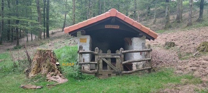
Mountain refuge Irubietako borda
We have it listed in the app!
We have it listed in the app!


With a privileged location in irubietako borda, txaradi bidea, rentería, guipúzcoa, país vasco, 20180, españa, the Irubietako borda refuge awaits you at 335 meters of altitude. Note its position (43.251, -1.863) before starting your route through the mountain range or massif.
15.1°C
Feels like: 15.7°C0.4 km/h
Gusts: 2.5 km/h4240 m
Snow lineUV 0
Clouds: 100% 19.98 mm
 13.8 km/h
 UV máx: 1.2
 06:28
06:28
 21:42
0.3 mm
8 km/h
UV máx: 7
06:28
21:43
0.2 mm
14.9 km/h
UV máx: 3.35
06:28
21:44
0 mm
9.7 km/h
UV máx: 7.5
06:27
21:44
0.3 mm
17 km/h
UV máx: 7.6
06:27
21:45
0.6 mm
16.3 km/h
UV máx: 7.2
06:27
21:46
0 mm
9.7 km/h
UV máx: 7.3
06:27
21:46
21:42
0.3 mm
8 km/h
UV máx: 7
06:28
21:43
0.2 mm
14.9 km/h
UV máx: 3.35
06:28
21:44
0 mm
9.7 km/h
UV máx: 7.5
06:27
21:44
0.3 mm
17 km/h
UV máx: 7.6
06:27
21:45
0.6 mm
16.3 km/h
UV máx: 7.2
06:27
21:46
0 mm
9.7 km/h
UV máx: 7.3
06:27
21:46
The forest slopes surrounding the municipality of Rentería, in the heart of Guipúzcoa, define a relief of half a mountain where the direct influence of the cantabrian climate and the persistent humidity mark the pattern of any outdoor activity. In this environment of secondary valleys and moderate altitude lomas, about 335 meters above sea level, Irubietako borda is located. Its strategic position in the Txaradi sector makes it a discrete reference point within the network of rural and forestry infrastructure that manage this territory. The surrounding terrain is characterized by dense vegetation and a network of forest tracks that require constant attention to cartographic orientation, especially in days where low cloud, a common phenomenon in this area of the Basque Country, drastically reduces visibility in the cords and small hills that make up the local landscape.
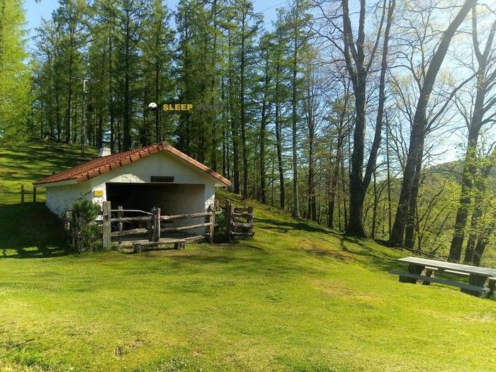
The planning of a mountain day in this sector should give priority to technical and logistical autonomy, as the facility operates under a free shelter system without care and guaranteed supplies. Although elevations such as Urdaburu or Zuarkazu are in the radius of action of this mountain shelter, access to water avitualation points is not immediate; the nearest source is located at a distance above the kilometre, a critical data that forces the mountainer to carry sufficient reserves from the starting point. Due to its modest level and relative proximity to rural areas, the building plays a supporting role in the face of unforeseen weather changes, but it should not be considered the axis of a overnight without a prior field check. The navigation through these paths, because they do not have large cross-roads immediately in the records, is subject to the experience in the use of positioning tools and to the knowledge of the network of local roads that connect the Gipuzcoan valleys.


Download the app and start looking for the shelter of your next adventure


Find a place to sleep before night falls.