Mountain refuge Courtaou d'Ordincede

We have it listed in the app!


            Mountain refuge Courtaou d'Ordincede in chemin de trassouet, sainte-marie de campan, campan, bagnères-de-bigorre, altos pirineos, occitania, francia metropolitana, 65710, francia
Five orange stars in a horizontal row representing a five-star rating.

Courtaou d'Ordincede

Lat: 42.995xxx – Lon: 0.237xxx
📍 chemin de trassouet, sainte-marie de campan, campan, bagnères-de-bigorre, altos pirineos, occitania, francia metropolitana, 65710, francia
Courtaou d'Ordincede

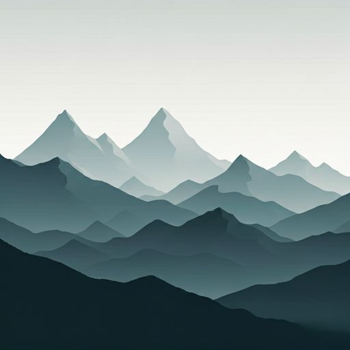
The Courtaou d'Ordincede refuge stands at 1324 meters above sea level, overlooking the surroundings of chemin de trassouet, sainte-marie de campan, campan, bagnères-de-bigorre, altos pirineos, occitania, francia metropolitana, 65710, francia. It is a key spot for mountaineers looking to spend the night or take a break. Its coordinates (42.995, 0.237) place it in a strategic position for exploring the peaks and trails of the region.

See more
See more
Usuario

Lucas Martinez

Premium user

Live weather: Courtaou d'Ordincede

At 1324 meters, the area around Courtaou d'Ordincede records 7.2°C with 99% cloud cover and a UV index of 0. The temperature will peak at 11.2°C today, with winds of 1.3 km/h and a freezing level of 3890 m.
Temperature

7.2°C

Feels like: 6.2°C
Wind

1.3 km/h

Gusts: 2.2 km/h
Freezing level 0°

3890 m

Snow line
Sky & UV

UV 0

Clouds: 99%

Next 48 hours evolution

7-day forecast

04/06
11.2° 5.9°
9.2 mm 13.3 km/h UV máx: 2.7
06:21 21:33
05/06
11.4°
0.4 mm 8.6 km/h UV máx: 5.35
06:21 21:34
06/06
13.8° 6.3°
3.2 mm 14.1 km/h UV máx: 6.95
06:20 21:34
07/06
19.7° 7.1°
1.7 mm 12.4 km/h UV máx: 7.75
06:20 21:35
08/06
16.5° 11.6°
2.1 mm 10.5 km/h UV máx: 7.3
06:20 21:36
09/06
11.2° 7.9°
3.9 mm 8.2 km/h UV máx: 2.7
06:19 21:36
10/06
16.5° 7.3°
0 mm 7.7 km/h UV máx: 7.45
06:19 21:37

Between Campan and the Lomas of the Lheris

Courtaou d'Ordincede is located in the surroundings of Sainte-Marie de Campan, 1324 meters, in an intermediate level that does not respond so much to an alpine passage shelter as to a useful support to move through the mountains that close the valley. From here the ground links with nearby reliefs like the Casque du Lhéris very close in distance, and with higher summits in the sector such as the Bassia sign , which gives meaning to its use as a starting point or of withdrawal on mountain days without the need to enter into extreme heights.

Their practical interest is increased by the network of itineraries passing through the area. In this sector there are tours such as the Bouchle d'Espiadet, the Sentier du Pacte des Loups, the GRP Chemin à la Gourgue d'Asque , Tour des Baronnies de Bigorre or Chemin du Piémont Pyrénéen . Rather than operating as an isolated destination, the shelter fits well in days that combine local paths with longer traverses, or as an option to break a route when time, meteor tiredness disadvise to extend the descent.

The basic logistics should be taken into account in planning. There are registered sources about 1.4 km away, a reasonable distance but sufficient to not have immediate water next to the coat. That detail can condition the starting load or the decision to stop here. In mountain, and more at a point of this kind, it is important to reach with autonomy and time change.

For orientation and access, this shelter fits better in exits where a simple base is sought in the Campan area than in a service-dependent stay. It may also be useful if a nearby ascension is raised and a height is sought on the eve, or if a journey through the cords of the area requires the reorganisation of the day on the ground.

Hiking routes from the refuge

Local

Sentier du Pacte des Loups

↔ Variable distance
Local

Boucle d'Espiadet

↔ Variable distance
GRP Chemin à la Gourgue d'Asque

GRP Chemin à la Gourgue d'Asque

↔ Variable distance
Local

Tour des Baronnies de Bigorre

↔ Variable distance
Local

Cabane de Conques

↔ Variable distance
22

Chemin du Piémont Pyrénéen

↔ Variable distance
21

Chemin du Piémont Pyrénéen

↔ Variable distance
Local

Chemin du Courtaou de Pla

↔ Variable distance

Nearby peaks

Signal de Bassia

1921 m
Lat: 42.9772 Lon: 0.3041

Casque du Lhéris

1595 m
Lat: 43.0146 Lon: 0.2312

Le Courouaou

1290 m
Lat: 42.9977 Lon: 0.1682

Soum Deth Raygade

756 m
Lat: 43.028 Lon: 0.2577

Pic de Carrot

Altitude not available
Lat: 43.019 Lon: 0.2971

Pic de Pène de Coussa

Altitude not available
Lat: 43.0185 Lon: 0.2874

Pic du Cap de Lusclade

Altitude not available
Lat: 43.025 Lon: 0.271

Pic du Montégut

Altitude not available
Lat: 43.0233 Lon: 0.284

Nearby water fountains

Fuente

1.4 Km
Lat: 43.0233 Lon: 0.284

Fuente

1.45 Km
Lat: 43.0233 Lon: 0.284

Fuente

3.64 Km
Lat: 43.0233 Lon: 0.284

Fuente

5.22 Km
Lat: 43.0233 Lon: 0.284

Fuente

5.39 Km
Lat: 43.0233 Lon: 0.284

Fuente

6.9 Km
Lat: 43.0233 Lon: 0.284

Fuente

6.98 Km
Lat: 43.0233 Lon: 0.284

Fuente

7.05 Km
Lat: 43.0233 Lon: 0.284
FAQ

Frequently asked questions

Pregunta frecuente
In which municipality or region is the Courtaou d'Ordincede refuge located?
This refuge is located within the municipality of Campan, belonging to the community or region of Occitania.
Pregunta frecuente
Are there other mountain refuges near Courtaou d'Ordincede?
Yes, nearby you can find other options to spend the night or take shelter. El refugio más próximo es el Cabane de Banios, que se encuentra a aproximadamente 0.6 km de distancia.
Pregunta frecuente
At what exact altitude is the Courtaou d'Ordincede refuge located?
The Courtaou d'Ordincede refuge is located at an altitude of 1324 meters above sea level, in the natural surroundings of chemin de trassouet, sainte-marie de campan, campan, bagnères-de-bigorre, altos pirineos, occitania, francia metropolitana, 65710, francia.
More areas

Other areas

Collaborative

Together we improve

image

Send your photos

You can upload photos of shelters and update their status so other users know if they can go there.

Get started
Get started
image

Rate the shelter

Leave your comments to rate the shelter’s condition. In the mountains, we look after each other.

Get started
Get started
image

Add new ones

Did we miss any? Publish the shelters you know so everyone can use them.

Get started
Get started
Download for free from the Apple App Store and Play Store.

Download the app and start looking for the shelter of your next adventure

Aplicación móvil para encontrar refugios de montaña donde dormir
Aplicación móvil para encontrar refugios de montaña donde dormir.
Mapa interactivo de refugios de montaña en los Pirineos dentro de la app
Mapa de refugios de montaña para senderismo y trekking en la app.
Pantalla con información de refugio de montaña con altitud capacidad y servicios
Pantalla con información de refugio de montaña con altitud capacidad y servicios.
Detalles de refugio de montaña con servicios y meteorología en aplicación móvil
Detalles de refugio de montaña con servicios y meteorología en aplicación móvil.
Aplicación para explorar refugios de montaña mediante mapa interactivo
Aplicación para explorar refugios de montaña mediante mapa interactivo.
Ficha completa de refugio de montaña con opiniones y servicios
Ficha completa de refugio de montaña con opiniones y servicios.
Información detallada de refugio en app para montañeros
Información detallada de refugio en app para montañeros.
Listado de refugios de montaña para senderismo y trekking
Listado de refugios de montaña para senderismo y trekking.
Explorar refugios de montaña desde una aplicación móvil
Explorar refugios de montaña desde una aplicación móvil.