Mountain refuge Corps de garde de Lanildut
We have it listed in the app!
We have it listed in the app!


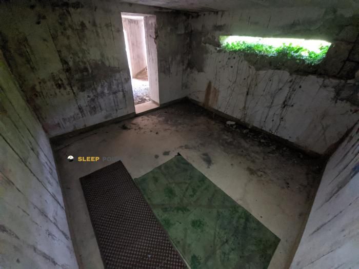
Discover the Corps de garde de Lanildut refuge, an alpine shelter located at 10 meters in the area of chemin des douaniers, ruludu, lanildut, brest, finisterre, bretaña, francia metropolitana, 29840, francia. Whether you are on a multi-day trek or a day hike, this point (48.473, -4.763) will provide the peace and shelter you seek in the mountains.
15.6°C
Feels like: 9.5°C39 km/h
Gusts: 60.1 km/h2270 m
Snow lineUV 0
Clouds: 100% 2.95 mm
 46.9 km/h
 UV máx: 7
 06:19
06:19
 22:14
2.05 mm
34.1 km/h
UV máx: 7
06:19
22:15
9.3 mm
44.4 km/h
UV máx: 7.15
06:18
22:16
0.15 mm
26.8 km/h
UV máx: 6.65
06:18
22:17
4.5 mm
23.6 km/h
UV máx: 4.8
06:18
22:18
2.4 mm
23.9 km/h
UV máx: 6.55
06:17
22:18
3 mm
31.3 km/h
UV máx: 2.1
06:17
22:19
22:14
2.05 mm
34.1 km/h
UV máx: 7
06:19
22:15
9.3 mm
44.4 km/h
UV máx: 7.15
06:18
22:16
0.15 mm
26.8 km/h
UV máx: 6.65
06:18
22:17
4.5 mm
23.6 km/h
UV máx: 4.8
06:18
22:18
2.4 mm
23.9 km/h
UV máx: 6.55
06:17
22:18
3 mm
31.3 km/h
UV máx: 2.1
06:17
22:19
The Lanildut Garde Corps is integrated as a key logistical element for those facing the coastal stages in the western end of France. Its location allows the progress to be broken by the Chemin des Douaniers, a long-range route that requires rigorous planning due to constant exposure to the Atlantic winds and the length of its sections between inhabited nuclei. For the senderist who travels between Portsall and Brest, this point represents a necessary step reference to manage the fatigue accumulated during the days of continuous march.
Access to the shelter environment is made following the sinuous coastal line, where the path remains at a low altitude above sea level. Despite the absence of large levels, progression requires attention to orientation at the crosses of neighborhood roads and low cliff sections. The land, marked by the saline influence and the granitic relief typical of Finisterre, offers a continuity that is only interrupted by the entrances of the rias that define the local geography and condition the pace of the journey.
The landscape surrounding the structure is deeply linked to the maritime activity of Lanildut, recognized for its historical relevance in seaweed collection. The environment has no peaks or alpine reliefs, focusing the experience in observing the dynamics of tides and the rastral vegetation of the Breton coast. As a strategic point in land-based navigation with a map, the shelter helps to be precisely located before bordering the estuaries that characterize this section of Britain, allowing to clearly identify the progression to the south.
In terms of logistics, the mountaineer must consider this shelter as a basic point of support where autonomy is fundamental. The availability of water is not immediate, the nearest points of supply are more than four kilometres away, which requires sufficient reserves to be loaded from the beginning of the day. This feature defines it as a step-by-step or visual reference rather than an installation with integrated services, strengthening the profile of a user used to self-sufficiency on long-distance routes.
Finally, its usefulness lies in the ability to provide a point of reference in an area where meteorology can change quickly, affecting the visibility and state of coastal paths. Those who travel the Chemin des Douaniers find here a place to reorganize the team or make technical stops before continuing to the populations of Brélès or Lampau-Plouarzel. It is, in essence, a fundamental piece to structure the long-breath coastal crossings through the French Northwest without relying exclusively on the urban cores.


📏 1.5 Km
⛰️ 6 m

📏 6.1 Km
⛰️ 10 m
📏 22 Km
⛰️ 60 m

📏 27 Km
⛰️ 20 m

📏 36 Km
⛰️ 21 m

📏 38.2 Km
⛰️ 45 m

📏 48 Km
⛰️ 5 m

📏 50.7 Km
⛰️ 33 m
Download the app and start looking for the shelter of your next adventure


Find a place to sleep before night falls.


