Mountain refuge Cabane de la Jasse de Peyriguels

We have it listed in the app!


            Mountain refuge Cabane de la Jasse de Peyriguels in cabanes de la jasse de peyriguels - ax les thermes, route de l'andorre, bouychet, siguer, foix, ariège, occitania, francia metropolitana, 09220, francia
Five orange stars in a horizontal row representing a five-star rating.

Cabane de la Jasse de Peyriguels

Lat: 42.728xxx – Lon: 1.579xxx
📍 cabanes de la jasse de peyriguels - ax les thermes, route de l'andorre, bouychet, siguer, foix, ariège, occitania, francia metropolitana, 09220, francia
Cabane de la Jasse de Peyriguels

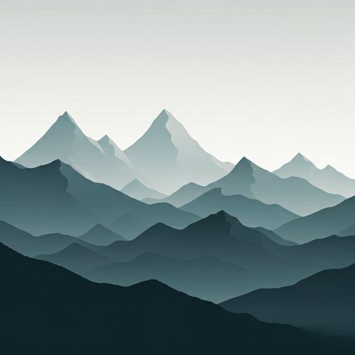
The Cabane de la Jasse de Peyriguels refuge (cabanes de la jasse de peyriguels - ax les thermes, route de l'andorre, bouychet, siguer, foix, ariège, occitania, francia metropolitana, 09220, francia) is a classic meeting point for mountaineers and hikers. At 1600 meters, its coordinates 42.728, 1.579 mark the end of a stage or the beginning of a new adventure.

See more
See more
Usuario

Lucas Martinez

Premium user

Live weather: Cabane de la Jasse de Peyriguels

Live weather report for Cabane de la Jasse de Peyriguels: current 8.8°C at 1600 meters (feels like 7.3°C). Wind at 2.6 km/h with gusts that may reach 6.5 km/h. The freezing level is at 4440 m and the maximum temperature will be 14.5°C.
Temperature

8.8°C

Feels like: 7.3°C
Wind

2.6 km/h

Gusts: 6.5 km/h
Freezing level 0°

4440 m

Snow line
Sky & UV

UV 0

Clouds: 93%

Next 48 hours evolution

7-day forecast

04/06
14.5° 5.6°
14.7 mm 13.2 km/h UV máx: 6.4
06:16 21:27
05/06
9.6° 1.4°
0.3 mm 13.3 km/h UV máx: 7.95
06:16 21:27
06/06
14.7° 6.9°
0.7 mm 10.9 km/h UV máx: 6.9
06:16 21:28
07/06
19.2° 8.6°
3.4 mm 14.6 km/h UV máx: 7.05
06:15 21:29
08/06
17.8° 8.1°
3.6 mm 12.7 km/h UV máx: 8.15
06:15 21:29
09/06
11.3° 6.1°
1.8 mm 9.4 km/h UV máx: 7
06:15 21:30
10/06
18° 6.1°
1.8 mm 8.7 km/h UV máx: 7.85
06:15 21:31

At 1600 meters, at the end of Follow , this cabin fits better as basic support than as a destination in itself. It is located on the side of the Occitania , on a land of medium and high mountain that is gaining alpine character towards the nearby hills, hills and tops. In this radio, the Pic du Sarrasi , Pic des Redouneilles , Pic du Pas de Bouc and Pique d'Endron useful references to understand that the shelter is left in a wide area of relief, with itineraries that can be quickly hardened according to the orientation and the weather.

Its most clear role is that of point of protection or withdrawal on mountain routes in this sector, rather than the base with determined logistics. Close by, they pass along as local variants to Col de Gamel or Roc de Quercéou and also the broader context of GR 10 on the French Pyrenees. This makes it a useful reference to divide day, correct a plan if time changes or have an intermediate coat on long routes between valleys and hills.

This should be raised with autonomy. The registered sources do not appear next to the shelter, but several kilometres away, so it is not wise to consider the availability of water in the vicinity. Nor should we assume equipment, capacity or services. In such an area, the practical value of the shelter depends above all on carrying its own space: safe water before rising, sufficient material for time changes and planning that, if conditions get worse, can function more as an emergency shelter than as full stage support.

Hiking routes from the refuge

Local

Roc de Querquéou

↔ Variable distance
CUC

Camí de l'Últim Càtar

↔ 189.64 km
GR 10

La traversée des Pyrénées - sec.3

↔ 110 km
AV03

Le Col de Gamel

↔ Variable distance
AV06

D'Illier à Lapège

↔ Variable distance
AV07

Le Chemin des Nobits

↔ Variable distance
AV08

Le Palet de Samsom

↔ Variable distance
TR17

Lapège et Pladetis

↔ Variable distance

Nearby peaks

Pic du Sarrasi

2213 m
Lat: 42.7271 Lon: 1.5248

Pic du Pas de Bouc

2602 m
Lat: 42.6772 Lon: 1.5889

Pic des Redouneilles

2485 m
Lat: 42.6886 Lon: 1.5469

Pique d'Endron

2472 m
Lat: 42.7196 Lon: 1.5166

Pic du Garbié de Bresoul

2047 m
Lat: 42.7353 Lon: 1.5299

Pic de Sauzeton

Altitude not available
Lat: 42.7219 Lon: 1.5111

Pic du Col Taillat

1959 m
Lat: 42.7353 Lon: 1.6131

Rocher de Miglos

1708 m
Lat: 42.7598 Lon: 1.6235

Nearby water fountains

Fuente

4.01 Km
Lat: 42.7598 Lon: 1.6235

Fuente

4.24 Km
Lat: 42.7598 Lon: 1.6235

Source du Pécalvette

4.44 Km
Lat: 42.7598 Lon: 1.6235

Fuente

7 Km
Lat: 42.7598 Lon: 1.6235

Fuente

7.23 Km
Lat: 42.7598 Lon: 1.6235

Fuente

7.33 Km
Lat: 42.7598 Lon: 1.6235

Fuente

7.86 Km
Lat: 42.7598 Lon: 1.6235

Fuente

8.05 Km
Lat: 42.7598 Lon: 1.6235
FAQ

Frequently asked questions

Pregunta frecuente
What are the GPS coordinates of the Cabane de la Jasse de Peyriguels refuge?
To locate the Cabane de la Jasse de Peyriguels refuge on your GPS or map, use the following coordinates: Latitude 42.728 and Longitude 1.579.
Pregunta frecuente
Is it necessary to carry a GPS to reach the Cabane de la Jasse de Peyriguels refuge?
It is always highly recommended to carry a GPS device, a route track, or a topographic map in the mountains. You can use the coordinates 42.728, 1.579 to locate this refuge precisely.
Pregunta frecuente
In which municipality or region is the Cabane de la Jasse de Peyriguels refuge located?
This refuge is located within the municipality of Siguer, belonging to the community or region of Occitania.
More areas

Other areas

Collaborative

Together we improve

image

Send your photos

You can upload photos of shelters and update their status so other users know if they can go there.

Get started
Get started
image

Rate the shelter

Leave your comments to rate the shelter’s condition. In the mountains, we look after each other.

Get started
Get started
image

Add new ones

Did we miss any? Publish the shelters you know so everyone can use them.

Get started
Get started
Download for free from the Apple App Store and Play Store.

Download the app and start looking for the shelter of your next adventure

Aplicación móvil para encontrar refugios de montaña donde dormir
Aplicación móvil para encontrar refugios de montaña donde dormir.
Mapa interactivo de refugios de montaña en los Pirineos dentro de la app
Mapa de refugios de montaña para senderismo y trekking en la app.
Pantalla con información de refugio de montaña con altitud capacidad y servicios
Pantalla con información de refugio de montaña con altitud capacidad y servicios.
Detalles de refugio de montaña con servicios y meteorología en aplicación móvil
Detalles de refugio de montaña con servicios y meteorología en aplicación móvil.
Aplicación para explorar refugios de montaña mediante mapa interactivo
Aplicación para explorar refugios de montaña mediante mapa interactivo.
Ficha completa de refugio de montaña con opiniones y servicios
Ficha completa de refugio de montaña con opiniones y servicios.
Información detallada de refugio en app para montañeros
Información detallada de refugio en app para montañeros.
Listado de refugios de montaña para senderismo y trekking
Listado de refugios de montaña para senderismo y trekking.
Explorar refugios de montaña desde una aplicación móvil
Explorar refugios de montaña desde una aplicación móvil.