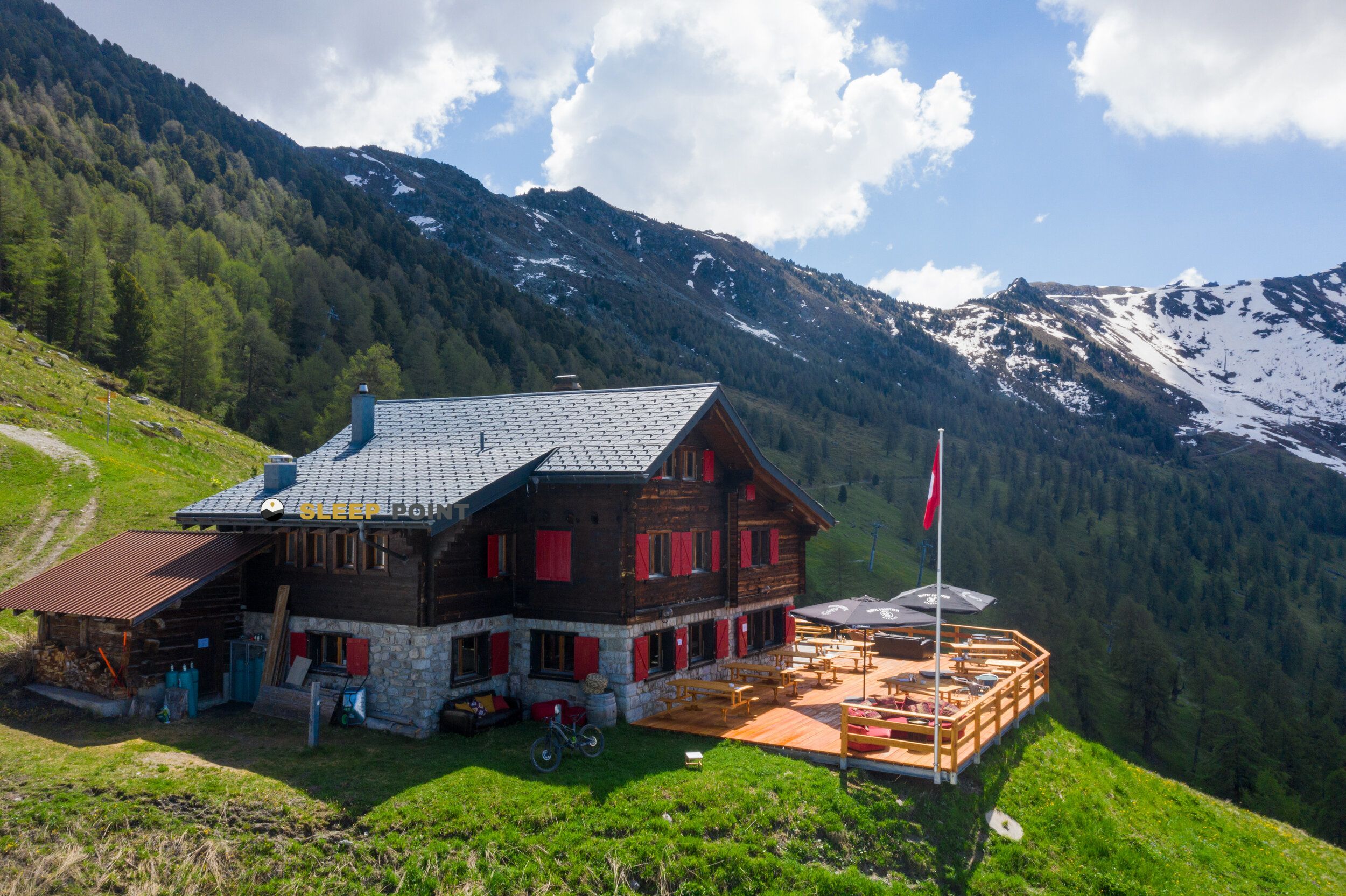
Mountain refuge Cabane d’Essertze
We have it listed in the app!
We have it listed in the app!


Strategically located in cabane d'essertze, backside greppon, hérémence, hérens, vallés, 1987, suiza, the Cabane d’Essertze refuge makes exploring the area easier. At 2191 meters above sea level, this point of interest (46.148, 7.372) is a vital resource when planning your route.
7.7°C
Feels like: 4.6°C2.5 km/h
Gusts: 22 km/h3780 m
Snow lineUV 0.55
Clouds: 100% 15.4 mm
 21.8 km/h
 UV máx: 6.3
 05:41
05:41
 21:16
2.2 mm
12.8 km/h
UV máx: 5.3
05:40
21:17
0 mm
11.1 km/h
UV máx: 6.55
05:40
21:18
0.1 mm
10 km/h
UV máx: 7.8
05:39
21:18
0 mm
10.8 km/h
UV máx: 7.8
05:39
21:19
7.05 mm
16.8 km/h
UV máx: 1.3
05:39
21:20
0.6 mm
10.6 km/h
UV máx: 7.75
05:39
21:20
21:16
2.2 mm
12.8 km/h
UV máx: 5.3
05:40
21:17
0 mm
11.1 km/h
UV máx: 6.55
05:40
21:18
0.1 mm
10 km/h
UV máx: 7.8
05:39
21:18
0 mm
10.8 km/h
UV máx: 7.8
05:39
21:19
7.05 mm
16.8 km/h
UV máx: 1.3
05:39
21:20
0.6 mm
10.6 km/h
UV máx: 7.75
05:39
21:20
The Cabane d'Essertze At 2191 meters, it fits well on a mountain day where the sharing of effort matters as much as the distance. Its position at the end of Héémence, within the Valais and in the surroundings of the Hérens valley, places it on a land already clearly alpine, above levels of continuous forest and more exposed to changes in time, wind and fast cooling. This altitude also explains that it does not function only as an isolated coat, but as a useful reference for those who move by crossing routes or by routes linking high and hills of the area.
Among the nearby routes is the Chamonix-Zermatt Walker's route, a relevant data because it suggests a use linked to long stages and the need to dosify up, rest and continuity of the journey. It also passes through the sector Le sentier des bouquetins, as well as senderist connections from Euseigne and Héémence. More than a short walk point, the shelter is better understood as a support in a day where the accumulated gap and the orientation on the mountain ground condition the rhythm. In this type of itinerary it is necessary to arrive with time margin, especially if the weather is complicated or if the stage continues towards higher levels.
The near relief reinforces that character. Very close appear Greppon Blanc and Mont Rouge , while in the wider environment, the Bec de la Montau , Les Louèrettes or Le Métailler . It is not necessary to present the cabin as a direct basis for ascension to understand that it is in an area of high slopes, crests and slope changes where the reading of the terrain influences fatigue and real times of passage.
From a logistical point of view, the most prudent data is autonomy. The registered sources are not attached to the shelter: the nearest ones are more than 2.5 km away. This suggests not having immediate water in the cabin environment and planning the stage with sufficient reserve, especially on hot days or if several high sections are linked. When a shelter is located in this altitude strip and far from clear points of supply, the previous organization weighs more than at low levels.
By location and context, the Cabane d'Essertze is more useful for mountaineers and hikers used to continuous days on alpine land than for an improvised exit. The combination of altitude, nearby crossing routes, mountainous relief and non-immediate water requires a good consideration of the load, the time and the evolution of the time before entering the area.


📏 6.3 Km
⛰️ 2485 m
📏 7.3 Km
⛰️ 2042 m

📏 8.1 Km
⛰️ 2662 m

📏 9.1 Km
⛰️ 1770 m

📏 9.4 Km
⛰️ 2575 m

📏 9.7 Km
⛰️ 2458 m

📏 10 Km
⛰️ 2457 m

📏 11 Km
⛰️ 2420 m
Download the app and start looking for the shelter of your next adventure


Find a place to sleep before night falls.


