Mountain refuge Bédélat du Cassaïre

We have it listed in the app!


            Mountain refuge Bédélat du Cassaïre in la reveillade, mandailles-saint-julien, aurillac, cantal, auvergne-rhône-alpes, francia metropolitana, 15590, francia
Five orange stars in a horizontal row representing a five-star rating.

Bédélat du Cassaïre

Lat: 45.077xxx – Lon: 2.625xxx
📍 la reveillade, mandailles-saint-julien, aurillac, cantal, auvergne-rhône-alpes, francia metropolitana, 15590, francia
Bédélat du Cassaïre

If you are planning a route through la reveillade, mandailles-saint-julien, aurillac, cantal, auvergne-rhône-alpes, francia metropolitana, 15590, francia, the Bédélat du Cassaïre refuge is a must-stop. Located at 1500 m above sea level, it offers hikers and climbers a safe place to regain strength. Save its coordinates (45.077, 2.625) in your GPS to stay on course during your journey.

See more
See more
Usuario

Lucas Martinez

Premium user

Live weather: Bédélat du Cassaïre

The current weather in Bédélat du Cassaïre indicates a temperature of 7.9°C, although the 16.6 km/h wind makes it feel like 5°C. Watch out for gusts of 59 km/h. The snow altitude (freezing level 0°) is around 4130 m and today we will reach a high of 8.3°C.
Temperature

7.9°C

Feels like: 5°C
Wind

16.6 km/h

Gusts: 59 km/h
Freezing level 0°

4130 m

Snow line
Sky & UV

UV 0

Clouds: 100%

Next 48 hours evolution

7-day forecast

04/06
8.3° 5.6°
31.1 mm 24.5 km/h UV máx: 2.45
06:04 21:31
05/06
9.1° 2.8°
2.4 mm 18.9 km/h UV máx: 7.5
06:03 21:32
06/06
12.2° 5.8°
0.1 mm 24.7 km/h UV máx: 6.35
06:03 21:33
07/06
16.6° 5.6°
0 mm 6.5 km/h UV máx: 7.05
06:02 21:33
08/06
15.4° 11.5°
5.25 mm 12 km/h UV máx: 7.05
06:02 21:34
09/06
12.3° 7.3°
5.7 mm 17.7 km/h UV máx: 7.2
06:02 21:35
10/06
16.7° 5.4°
0 mm 7.6 km/h UV máx: 7.6
06:02 21:35

Crossing the Cantal

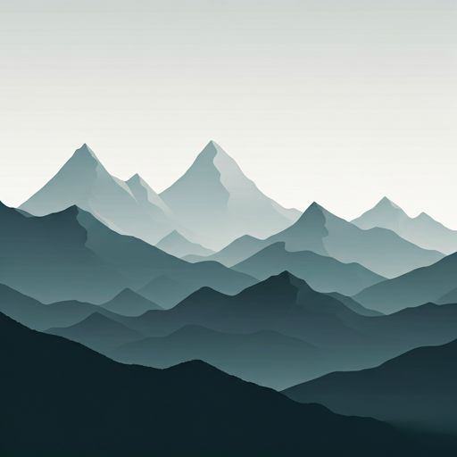
The approach to Bédélat du Cassaïre It fits better in hiking days with continuity than in an improvised short exit. In the surroundings of Mandailles-Saint- Julien, within the Cantal Mountains , the terrain responds to the broad and eroded relief of this volcanic massif, with lomas, orientation changes and routes that force to decide well where to link. That is why its role makes more sense as a step-by-step shelter: it allows to break stages, reorganize a journey or have a point of support between identified itineraries of the area, such as the VA 10 and VA 11 sectors, in addition to the Sentier of Bois Mary. At about 1500 meters of altitude, the environment can already be fresh, windy and changing, especially when the weather revolves in the nearby crest and hills.

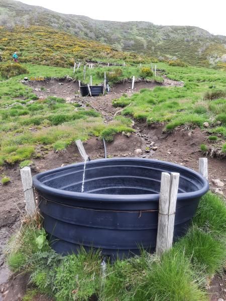
Its practical interest is in this intermediate position within a fairly open mountain sector, with close peaks as Chavaroche , Elancèze or the Roc du Chauve functioning more as a reference of the relief than as a forced target from the shelter. For those who travel the area on foot, it is appropriate to plan the day with autonomy: the nearest registered source is about 2.7 km away, so it is not wise to have immediate water in the environment of the coat. No specific equipment or services should be taken for granted if they have not been established before. In this context, Bédélat du Cassaïre is particularly useful for mountain and mountain trails that already arrive with a linked route, basic reading of the ground and margin to adapt the stage according to the time, visibility or state of the route.

Hiking routes from the refuge

Local

VA 10 : Murat - Saint-Jacques-des-Blats

↔ 25 km
VA11

VA 11 : Saint-Jacques-des-Blats - Vic-sur-Cère

↔ 16.5 km
Local

Sentier de Bois Mary

↔ Variable distance

Nearby peaks

Chavaroche

1739 m
Lat: 45.0963 Lon: 2.6448

Roc d'Hozières

1614 m
Lat: 45.1144 Lon: 2.6428

Luc

1334 m
Lat: 45.072 Lon: 2.5645

Elancèze

1571 m
Lat: 45.0516 Lon: 2.6651

Roc de Longle

1393 m
Lat: 45.0322 Lon: 2.6295

Le Roc du Chauve

1427 m
Lat: 45.0497 Lon: 2.6492

Pas de Mandailles

1386 m
Lat: 45.0506 Lon: 2.6542

Courpou Sauvage

1521 m
Lat: 45.045 Lon: 2.6395

Nearby water fountains

Fuente

2.7 Km
Lat: 45.045 Lon: 2.6395

Fuente

4.24 Km
Lat: 45.045 Lon: 2.6395

Fuente

7.59 Km
Lat: 45.045 Lon: 2.6395

Fuente

7.93 Km
Lat: 45.045 Lon: 2.6395

Fuente

8.6 Km
Lat: 45.045 Lon: 2.6395

Fuente

9.05 Km
Lat: 45.045 Lon: 2.6395

Fuente

9.82 Km
Lat: 45.045 Lon: 2.6395

Fuente

9.97 Km
Lat: 45.045 Lon: 2.6395
FAQ

Frequently asked questions

Pregunta frecuente
At what exact altitude is the Bédélat du Cassaïre refuge located?
The Bédélat du Cassaïre refuge is located at an altitude of 1500 meters above sea level, in the natural surroundings of la reveillade, mandailles-saint-julien, aurillac, cantal, auvergne-rhône-alpes, francia metropolitana, 15590, francia.
Pregunta frecuente
What are the GPS coordinates of the Bédélat du Cassaïre refuge?
To locate the Bédélat du Cassaïre refuge on your GPS or map, use the following coordinates: Latitude 45.077 and Longitude 2.625.
Pregunta frecuente
Is it necessary to carry a GPS to reach the Bédélat du Cassaïre refuge?
It is always highly recommended to carry a GPS device, a route track, or a topographic map in the mountains. You can use the coordinates 45.077, 2.625 to locate this refuge precisely.
More areas

Other areas

Collaborative

Together we improve

image

Send your photos

You can upload photos of shelters and update their status so other users know if they can go there.

Get started
Get started
image

Rate the shelter

Leave your comments to rate the shelter’s condition. In the mountains, we look after each other.

Get started
Get started
image

Add new ones

Did we miss any? Publish the shelters you know so everyone can use them.

Get started
Get started
Download for free from the Apple App Store and Play Store.

Download the app and start looking for the shelter of your next adventure

Aplicación móvil para encontrar refugios de montaña donde dormir
Aplicación móvil para encontrar refugios de montaña donde dormir.
Mapa interactivo de refugios de montaña en los Pirineos dentro de la app
Mapa de refugios de montaña para senderismo y trekking en la app.
Pantalla con información de refugio de montaña con altitud capacidad y servicios
Pantalla con información de refugio de montaña con altitud capacidad y servicios.
Detalles de refugio de montaña con servicios y meteorología en aplicación móvil
Detalles de refugio de montaña con servicios y meteorología en aplicación móvil.
Aplicación para explorar refugios de montaña mediante mapa interactivo
Aplicación para explorar refugios de montaña mediante mapa interactivo.
Ficha completa de refugio de montaña con opiniones y servicios
Ficha completa de refugio de montaña con opiniones y servicios.
Información detallada de refugio en app para montañeros
Información detallada de refugio en app para montañeros.
Listado de refugios de montaña para senderismo y trekking
Listado de refugios de montaña para senderismo y trekking.
Explorar refugios de montaña desde una aplicación móvil
Explorar refugios de montaña desde una aplicación móvil.