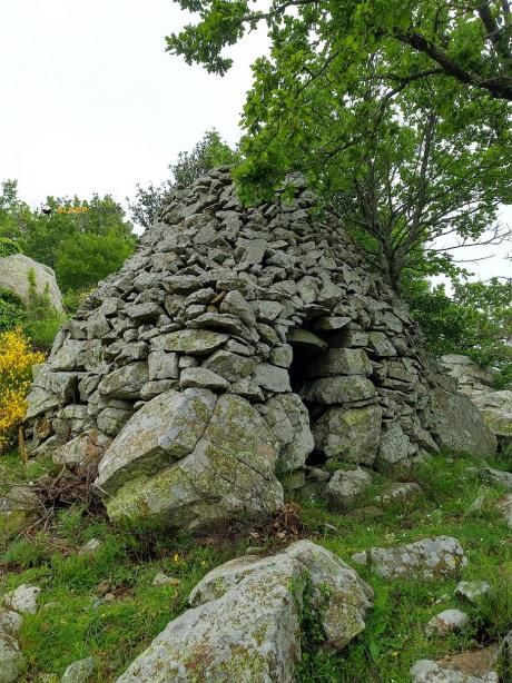
Mountain refuge Abri de Tarabaus
We have it listed in the app!
We have it listed in the app!


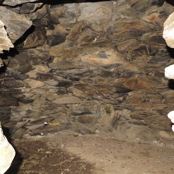
The mountains of borne frontière 596, carrer democràcia, molinàs, can pellic, colera, alto ampurdán, gerona, cataluña, 17496, españa hide essential places like the Abri de Tarabaus refuge. Situated at an elevation of 607 meters, it offers protection and rest. Its exact coordinates are 42.43, 3.104.
19.9°C
Feels like: 19°C9.4 km/h
Gusts: 23 km/h4150 m
Snow lineUV 3.2
Clouds: 100% 26.33 mm
 28.5 km/h
 UV máx: 7.25
 06:11
06:11
 21:20
0 mm
29.4 km/h
UV máx: 5.95
06:11
21:20
0 mm
12.4 km/h
UV máx: 6.9
06:11
21:21
0 mm
14.3 km/h
UV máx: 7.15
06:10
21:22
0 mm
19.8 km/h
UV máx: 7.75
06:10
21:22
0 mm
26 km/h
UV máx: 7.3
06:10
21:23
0 mm
20.7 km/h
UV máx: 7.35
06:10
21:23
21:20
0 mm
29.4 km/h
UV máx: 5.95
06:11
21:20
0 mm
12.4 km/h
UV máx: 6.9
06:11
21:21
0 mm
14.3 km/h
UV máx: 7.15
06:10
21:22
0 mm
19.8 km/h
UV máx: 7.75
06:10
21:22
0 mm
26 km/h
UV máx: 7.3
06:10
21:23
0 mm
20.7 km/h
UV máx: 7.35
06:10
21:23
Before considering it as day support it is necessary to have water autonomy: the registered sources are several kilometres away, and the nearest, the Font de Sant Miquel, is about 3.6 km away. The Abri de Tarabaus appears in the term Colera, in the Upper Ampurdan, within a half-mountain strip very close to the border border, with references such as Molinàs and Bern 596. At 607 meters of altitude, it does not respond to the high-level pyrenees shelter pattern, but to the basic coat pattern in a dry saw, open and exposed to wind and orientation changes.
Its utility is mainly in light mountain or local mountain tours through the cords that link lomas and hills of this eastern part of Catalonia. The closeness of the Puig de Taravaus , a little more than half a mile, and of tops like the Puig de l'àliga o The Petita Tower helps to understand the terrain: succession of modest but broken reliefs, where the changes of the side can change the progression, the exposure and the visual reference to sea or interior. With the information available, it is more reasonable to interpret it as a safe haven free of timely support than as a basis for a defined itinerary. It is therefore necessary to arrive with mapping, sufficient water and scope to resolve the day without depending on services or route connections previously drawn.


📏 2.1 Km
⛰️ 600m m

📏 4.7 Km
⛰️ 350 m

📏 5.6 Km
⛰️ 200 m

📏 7.4 Km
⛰️ 956 m

📏 7.4 Km
⛰️ 975 m

📏 8.5 Km
⛰️ 790 m

📏 8.6 Km
⛰️ 790 m
📏 10.6 Km
⛰️ 945 m
Download the app and start looking for the shelter of your next adventure


Find a place to sleep before night falls.


