Mountain refuge Abri de la Place au Charbon

We have it listed in the app!


            Mountain refuge Abri de la Place au Charbon in d 437a, plain, charmauvillers, montbéliard, doubs, borgoña-franco condado, francia metropolitana, 25470, francia
Five orange stars in a horizontal row representing a five-star rating.

Abri de la Place au Charbon

Lat: 47.233xxx – Lon: 6.941xxx
📍 d 437a, plain, charmauvillers, montbéliard, doubs, borgoña-franco condado, francia metropolitana, 25470, francia
Abri de la Place au Charbon

Discover the Abri de la Place au Charbon refuge, an alpine shelter located at 510 meters in the area of d 437a, plain, charmauvillers, montbéliard, doubs, borgoña-franco condado, francia metropolitana, 25470, francia. Whether you are on a multi-day trek or a day hike, this point (47.233, 6.941) will provide the peace and shelter you seek in the mountains.

See more
See more
Usuario

Lucas Martinez

Premium user

Live weather: Abri de la Place au Charbon

The current weather in Abri de la Place au Charbon indicates a temperature of 13.8°C, although the 10.7 km/h wind makes it feel like 11.9°C. Watch out for gusts of 24.1 km/h. The snow altitude (freezing level 0°) is around 3740 m and today we will reach a high of 17.4°C.
Temperature

13.8°C

Feels like: 11.9°C
Wind

10.7 km/h

Gusts: 24.1 km/h
Freezing level 0°

3740 m

Snow line
Sky & UV

UV 0

Clouds: 78%

Next 48 hours evolution

7-day forecast

04/06
17.4° 12.3°
14.5 mm 17.1 km/h UV máx: 6
05:38 21:22
05/06
15.7° 10.7°
4.9 mm 11.4 km/h UV máx: 6.95
05:37 21:23
06/06
20.2° 10.5°
0 mm 17.1 km/h UV máx: 7.2
05:37 21:24
07/06
20.1° 12°
0 mm 14.8 km/h UV máx: 6.3
05:37 21:25
08/06
24° 12.2°
2.85 mm 11.2 km/h UV máx: 6.8
05:36 21:25
09/06
18° 12.3°
12 mm 18.6 km/h UV máx: 6.8
05:36 21:26
10/06
19.9° 8.7°
0 mm 13.4 km/h UV máx: 7
05:36 21:27

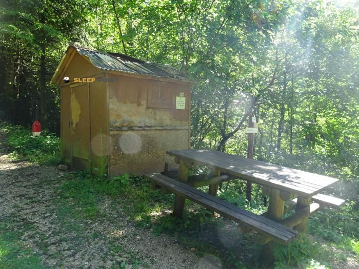
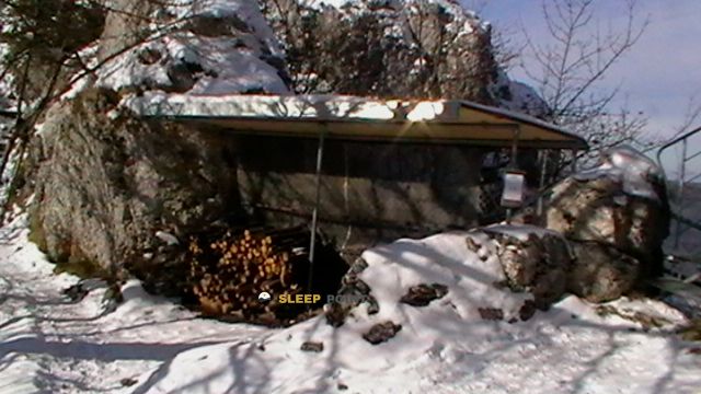
It is appropriate to arrive with the well thought out logistics. In Abri de la Place au Charbon there are no useful data on inside equipment, and the water should not be taken for granted in the coat itself. The nearest reference appears at about 760 meters, with other sources somewhat further away, so autonomy remains important, even at a moderate level of 510 meters. In this part of the Doubs, near Charmauvillers , the use of the shelter fits more as a step support than as a destination in itself.

Its position is interesting within the mosaic of roads linking the border sector between French County Franco and Swiss Jura. In the environment, there are trails that connect areas such as Les Pommerats , Saignelégier , Sommêtres or Muriaux , which places this free shelter in a transit area between small slopes, plateaus and local steps rather than in a high mountain scenario. This link function is probably its most useful feature: to serve as a guard on a long day or on a fragmented journey by variable stages.

Access, by geographical context, seems to be associated with rural roads and low-mountain trails, not alpine land. However, the requirement does not depend only on the altitude. They also weigh the actual length of the chosen itinerary, the meteorology and the continuity of the march between scattered nuclei. In an open and relatively unabrupt area, such a coat can solve a timely need for protection, but it does not replace complete planning.

The mention of the d 437th and the plain of Charmauvillers It helps to place it in an accessible environment on the map, although this does not involve immediate or easy access on foot from any point. Their interest is in this intermediate position, useful to those who cross the sector without closing the day in population. More than ascension base, Abri de la Place au Charbon It functions as a support point for the cross-border travel between localities, forest borders and near-border liaison roads.

If it is proposed as a free-of-passage shelter in Borgoña- Franco Condado, it is reasonable to have secure water before leaving or locating the nearest source with margin, to review mapping of the specific itinerary and not to give for alleged services that do not contain here. This prudence fits well with the character of the place and its role within open, variable and unstandardized routes.

Hiking routes from the refuge

Local

Les Pommerats - Saignelégier

↔ Variable distance
Local

Sommêtres - fixme

↔ Variable distance
Local

Sommêtres - Pt. 1079

↔ Variable distance
Local

Sommêtres - fixme

↔ Variable distance
Local

Sommêtres - Muriaux halte CJ

↔ Variable distance
Local

Muriaux halte CJ - Muriaux

↔ Variable distance
Local

Muriaux - Goumois

↔ Variable distance
Local

fixme - fixme

↔ Variable distance

Nearby water fountains

Fuente

760 m
Lat: 0 Lon: 0

Fuente

1.47 Km
Lat: 0 Lon: 0

Fuente

1.47 Km
Lat: 0 Lon: 0

Fountain

1.99 Km
Lat: 0 Lon: 0

Fuente

3.32 Km
Lat: 0 Lon: 0

Fuente

3.32 Km
Lat: 0 Lon: 0

Fuente

3.34 Km
Lat: 0 Lon: 0

Fuente

3.34 Km
Lat: 0 Lon: 0
FAQ

Frequently asked questions

Pregunta frecuente
Are there other mountain refuges near Abri de la Place au Charbon?
Yes, nearby you can find other options to spend the night or take shelter. El refugio más próximo es el Refuge des Sommêtres, que se encuentra a aproximadamente 1.9 km de distancia.
Pregunta frecuente
At what exact altitude is the Abri de la Place au Charbon refuge located?
The Abri de la Place au Charbon refuge is located at an altitude of 510 meters above sea level, in the natural surroundings of d 437a, plain, charmauvillers, montbéliard, doubs, borgoña-franco condado, francia metropolitana, 25470, francia.
Pregunta frecuente
What are the GPS coordinates of the Abri de la Place au Charbon refuge?
To locate the Abri de la Place au Charbon refuge on your GPS or map, use the following coordinates: Latitude 47.233 and Longitude 6.941.
More areas

Other areas

Collaborative

Together we improve

image

Send your photos

You can upload photos of shelters and update their status so other users know if they can go there.

Get started
Get started
image

Rate the shelter

Leave your comments to rate the shelter’s condition. In the mountains, we look after each other.

Get started
Get started
image

Add new ones

Did we miss any? Publish the shelters you know so everyone can use them.

Get started
Get started
Download for free from the Apple App Store and Play Store.

Download the app and start looking for the shelter of your next adventure

Aplicación móvil para encontrar refugios de montaña donde dormir
Aplicación móvil para encontrar refugios de montaña donde dormir.
Mapa interactivo de refugios de montaña en los Pirineos dentro de la app
Mapa de refugios de montaña para senderismo y trekking en la app.
Pantalla con información de refugio de montaña con altitud capacidad y servicios
Pantalla con información de refugio de montaña con altitud capacidad y servicios.
Detalles de refugio de montaña con servicios y meteorología en aplicación móvil
Detalles de refugio de montaña con servicios y meteorología en aplicación móvil.
Aplicación para explorar refugios de montaña mediante mapa interactivo
Aplicación para explorar refugios de montaña mediante mapa interactivo.
Ficha completa de refugio de montaña con opiniones y servicios
Ficha completa de refugio de montaña con opiniones y servicios.
Información detallada de refugio en app para montañeros
Información detallada de refugio en app para montañeros.
Listado de refugios de montaña para senderismo y trekking
Listado de refugios de montaña para senderismo y trekking.
Explorar refugios de montaña desde una aplicación móvil
Explorar refugios de montaña desde una aplicación móvil.